Land Navigation Course (The Grid) Lesson 2

Vložit
- čas přidán 30. 10. 2019
- Learning Objectives:
2-1. Understand how to read grid coordinates
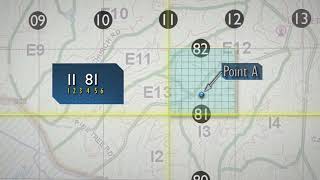
2-2. Understand what a 4 digit, 6 digit and 8 digit coordinate are
2-3. Understanding the difference between Magnetic North, True North and Grid North.
2-4. Understanding an azimuth
2-5. Understanding Terrain Features
2-6. Understand the difference between magnetic azimuth, and grid azimuth.
2-7. Understand how to plot a grid azimuth and know how to convert it into magnetic azimuth
2-8. Understand how to plot a magnetic azimuth
A FREE PDF book of all 7 lessons so you study on your own and will be made available to download on our website under courses at maccabbeebushcraft.com
www.maccabbeebushcraft.com/na...
#landnavigation #navigation #bushcraftsurvival


One of the rare Lensatic instructional videos that knows the proper way to do the compass to cheek sighting method. Most of them fold down the sight wire at a 45 degree angle. I think they confuse the Lensatic with a baseplate style compass. There’s no mirror on the Lensatic, the sight wire should be vertical. Thank you
Just a line to let you know you have earned you a full 10/10
Hi! Helpful tips and cool videos! 👍🏼👍🏼👍🏼 Keep on the great content 🤘🏼
Thanks buddy! I appreciate the comment.
Another great video which offers a good amount of information that is presented in a manner easy to follow. I look forward to seeing part 3.
Thanks buddy I look forward to finishing these videos this year.
Awesome
Great videos. Jut please turn down the intro volume. If I didn't need hearing aids, I probably will after have your intro wake the dead lol
When you sight a distant object, like a tree, say its in 270degrees, and I have a declination of 11.72e, on a lensatic compass do I jusr follow the magnetic bearing of 270 or after subtracting ex east is least I get 258.28, do I adjust the compass to 258? that would mean the tree would be off, sorry If it doesnt make sense...
Just wondering if you were confused for a moment on the grid to magnetic (map to compass)? If you move the bezel to the left it adds the declination to the azimuth and if you move to the right it takes declination value off of azimuth. Because I live in the East I have a Westerly declination which is a negative number. -7.5 degrees in my area. Grid to magnetic you subtract. So if I have 0 degrees - (-7.5) which is really adding then I get 7.5 degrees on my lensatic compass by moving bezel to the left so I can orient my map.
Sounded to me like he got them backwards because for an East declination you subtract and for Western declination you end up adding , important to remember its a negative value -(-x)= x , so its ADDED…. Iam also in the East and my declination is -12 deg West. Grid to Mag = ADD …. Mag to Grid = subtract…. The Magnetic angle is always Greater then the Grid angle for Western Declination.
Grid Angle is always larger then magnetic for Eastern declinations. Thats how i rememeber it.
His directions had me all fouled up for a minute there.
Nice video. Informative. But wow, a three minute plus intro montage before the actual video. I don't think openings to Hollywood movies last that long.
You have a talent explaining a complicated matters, into understandable language. How do you recommend using the Lensatic compass if you forget your protractor? especially when you want to determine a grid azimuth on the map?
Do you mean can you plot a grid coordinate or can you merely determine a grid azimuth because a grid azimuth is simply a degree reading from one point on a map to another, whereas a grid coordinate on the other hand is trying to plot a point using 6 to 8 digit grid coordinance is to be honest done to lesson the inaccuracy of your distance to the area or land mark. In truth you dont need to know a grid coordinate unless you wanting someone to know exactly where you are located or need to be at. Whereas if you are merely wanting to plot a point on the map you can know generally your location by using land marks and degree readings by by using a two or one point resection method to get an idea of you location you will just be about 100 meters in proximity to that area thats all on a 1:24,000. But that can vary depending upon what scale of map as a more higher scale will make you more further in proximity and a more small scale lesser in distance
@@maccabbeebushcraft5546 When you set in your map your starting point (a) and draw a strait line to a destination (b), You can grab the protractor and determine the grid azimuth to point b. Now you have a Grid direction you can follow on your compass. If I had a base plate compass I could use it as a protractor to determine the same grid azimuth if I align my north south lines on my base plate to the map. My question how could I use my lensatic compass to do the same? meaning I only have my compass and map no protractor?
@@ramtrev8215 email me your address and I can send you some pictures if you would like just send it to maccabbeebushcraft@gmail.com
@@ramtrev8215 Hey Ramiro sorry its taken me so long to reply but I had to do some thinking and research before I could reply to this. The lensatic compass theoretically could and what I mean by theoretically is that realistically speaking the ruler which is found on the side of the compass if you ignore the 1:50000 marking which might confuse you some is actually carved noches on the side in increments using centimeters however and this is a important point to focus upon the larger carved nouches are the begining and end of a whole centimeter. While the smaller nouches are in increments of two millimeters, which means your even number millimeters are missing and you would need to use a sharp pencil to divide evenly between the odd millimeter nouches to define those numbers. So here is some things you can consider. First you need to know what scales of map you will be using.
If 1:10,000 then 1cm = 100 meters
If 1:14,000 then 1cm = 140 meters
If 1:20,000 then 1cm = 200 meters
And so on.....
Great stuff man... but why do you have over 3 1/2 minutes of instruction and the music so loud, very unnecessary. Other than that, great stuff.
Sorry if you feel the intro is too long I think I may change this in the other upcoming videos in this series.
Excellent video you lost me on back azimuth
The back azimuth is just the degree opposite of the degree your heading to. So if you going 360 degrees toward a destination the reverse or backwards direction would be 180 degrees. Makes sense now?
great video but holy fuck that intro was unnecessarily long
Mr Bubbles ......Tone down the intro you scaring the shit out of the grand kids otherwise a great video
Whew. That info segment nearly wore me out. And when, exactly, is survival not "essential?" Free tips: First, shorten your introduction to about 6 seconds. That's plenty. 2. Your editor flubbed by by stating that survival is "essential." I think we all want to survive, and go on living. Also, when I was in the Marine Corps, nearly 60 years ago, I was the best Land Nav student in the battalion, at ITR.
Im so proud of your accomplishments which is great to boast about to no one as we Marines have nothing to boast in but merely are to walk with the pride we have only desired to protect and defend our country. That being said I cannot edit this video as it would effect the view count and have to be be reposted in order to do so. And news flash not all people young and old think like we do having served. Being a grunt serving in Marine Corps I seek to help those who dont know much about survival, let alone skills they would not have known unless one helps them see their importance. Hope this clarifies things.
3:40 of Introduction? In that time I WANTED to be lost & unable to get back to civilisation & technology. A little LESS Showman & a LOT more KNOWMAN. I lost the will to live way before your annoying intro was over.
Your introduction is infuriating. Fu for that. Otherwise the actual content is great
Cut the useless 4 minutes bro. Really