Land Navigation Course (The Compass) Lesson 1

Vložit
- čas přidán 25. 07. 2024
- Learning Objectives:
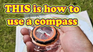
1-1. Understand the function of a Lensatic compass and its make up
1-2. Understand what is Magnetic North, and Grid North.
1-3. Understanding why we use the UTM (Universal Transverse Mercator Zone Chart)
1-4. Understand what is map scale is and why there is a difference in maps
1-5. Understanding the colors used on a map
1-6. Understanding a maps layout and structure
1-7. Understanding the declination chart
1-8. Understand when Magnetic North must be converted into Grid North
1-9. Understand how to orientate your compass to read Grid North
A FREE PDF book of all 7 lessons so you study on your own and will be made available to download on our website under courses at maccabbeebushcraft.com
www.maccabbeebushcraft.com/na...
#landnavigation #navigation #bushcraftsurvival


The intro music made me immagine that I was standing in a large room, surrounded hundreds of enemies armed with mele weapons, waiting to attack; then they suddenly attack, and I pull a Jason Borne and just start taking them out with nothing but my bare hands 🥋 🤛 🤜 👋 🦵 🐉 🐅.
I guess Im still a kid at heart 🤷
Thanks for the video; I really needed a refresher. 🙏🏼
This is the best explanation I got so far on adjusting the lensentic compass from grid north to magnetic north
Your video is quite in depth and educational. Thank you for taking the time to make to create this video.
Thanks so much for the video lesson, help me a lot!
can't handle your intro!
1:39 long erratic loud music! Ugh! Too much!
Just the intro was worth clicking the subscribe button
Good video man! I teach land nav in the Air Force and your video is spot on! Good stuff!
Thanks buddy I got more videos to finish making so they can complete the whole course
Excellent educational video! Thank you for doing it!
We will be coming out more soon so keep a watch out! And thanks for watching!
Dear Sir.
You seem to have a great deal of knowledge, & I am very glad you see fit to share this with others. I have actually come across your name from other content creators so you know. I am not by any means attempting to be rude, disrespectful, or take anything away from your knowledge base. With that said, I watched this video & attempted to watch the second in this series. Unfortunately you do not stay on a clear path with your teachings. Honestly if I had not of watched an episode from a different creator already, you would have lost me in this video & I would have never made it to the next one. Your lessons need more fluidity please. Again I see that you know what you are speaking of, unfortunately it is being lost in translation. Thank you for your time.
Fantastic videos with great explanations and also very educational. I have simple question. For the Cammenga Lensatic compasses which are balanced for Northern and Southern hemispheres, which model is suited for use in South East Asia like Singapore, Malaysia and Thailand? I live in Singapore and would like to purchase a Cammenga Lensatic compass. Please advise. Thanks!!!!!!
Since your comment is over a year old, I’m not sure if you are still in need of this information , but since no one answered you, I’ll give you my opinion.
The Camenga compass model used by the US military is the Camenga model 3H. There are 2 versions: one with tritium and the other with phosphorescent (for nighttime navigation ). The tritium dies out in 10 to 15 years and is more expensive. For most people, it’s best to go with the phosphorescent model. One important thing to remember is that the Camenga H3 does not have a global needle, so you have to make sure you get the one that is suitable for your hemisphere. As far as I know, there is not a global version.
What I do is I use a Sunto MC-2g (the Sunto MC2 global model) for navigation, and I keep the Camenga in my pack as a backup. The Sunto is great because it has a global needle which allows it to function anywhere in the world, a signal mirror, and more importantly, a declination adjustment. This way, once you set the declination, you no longer have to convert back and forth between grid and magnetic bearings. It also has a clinometer so you can measure elevation.
The only downside is that it is liquid filled which has a risk of developing air bubbles with extreme changes in elevation and temperature, and since it is made of plastic, it is not as durable as the Camenga. So if you can afford it, it is worth having both. Otherwise, at least you now have some information so you can make an informed decision. Good luck!
Lines of Latitude run east to west, but measure distance from north to south; while lines of longitude run north to south, but measure distance east to west. Unless I’m misunderstanding, it sounded like you were saying that latitude measure east to west and longitude measure north to south. I’m only pointing this out so that beginners aren’t confused, because this stuff can be overwhelming when you first start learning
Where is a good source to getting 1:25 scale maps?
Thanks
Could I carry the cammenga compass in my EDC? Would it be damaged by everyday magnetic objects if I were to store it in my bag?
Eh Captain....No there is no problem with it being carried that way. The Cammenga compass has a metal case which forces the compass needle to remain still in transport. So your fine just keep in mind get away from meta objectsl when using it
Can the Lensatic Compass be used world wide like the Suunto MC-2G ?
And, can it be used in place of the PROTRACTOR for map bearing ?
Yes, it can be used worldwide as well as even repaired and fixed on site as these subjects I will go into detail in other videos. As for being used in place of a protractor, I am assuming you mean can you use the angle bearing of the compass in place of angle or degree bearings that exist on the protractor. Yes, but you need to make sure two things are done first make sure the declination is added to your bezel ring first, as you will need to convert your magnetic bearing into grid first so that your map reading is focused upon grid north and not the magnetic north or you will be seriously off course if you do not convert your compass to read grid north and then you will be plotting off course, than orientate your map so that the map is facing north in the direction the declination added reads. Than what ever plots you have added to your map you can simply just use the ruler side of your compass to align the two plotted points and from there you can get your angle or degree reading from that. But then before stepping off you will need to convert the compass back to read magnetic north and adjust accordingly to add the needed degrees back onto your magnetic course and head in that corret direction using magnetic azimuth.
@@maccabbeebushcraft5546 its not global. there are northern hemisphere and a southern hemisphere versions.
Is there any metal in your glasses?
Good video. Gotta cut down that intro, man. Almost left the video cause of it
1:40 intro? Get out of here with that.
Thanks for the timestamp 🤙
this is very hard to learn and understand for newbie (beginners like me )who want to learn how to use the compass and read the map :( .
Down the free pdf and you can read over and over again the website in the description.
Keep practicing! It will begin to make sense.
What's with the intro bro? This ain't the matrix. Skip to 1:38 when you want to begin the lesson people.
WTF was that first 90 seconds about?
Well it all started out one day when I decided to edit my video I made that the music was so intriguing to my ears I thought lets use this for the intro and tick off Steven Dunne who will one day watch it in some far away future date.
@@maccabbeebushcraft5546 it doesn't tick me off, but it does make you look like an ass.
This is supposed to be lesson 1 on the compass, not a lesson on maps. You lost me before half way through this one.
Too much introduction/music. I lost interest….
Intro tooooo long