[AUTOCAD ARCHITECTURE #1]CREATE 3D TERRAIN FROM CONTOUR LINES & EXPORT 3D TERRAIN TO STL FORMAT

Vložit
- čas přidán 12. 09. 2024
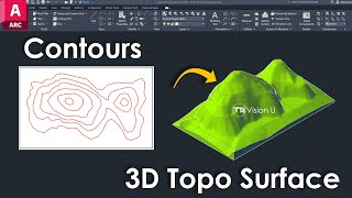
- This video explains how to create 3D Terrain in Autocad Architecture using the contour lines.
After creating 3D Terrain, you can export it to .STL format (i.e. Lithography format) by converting the 3D Terrain in 3D Solids (Water tight mesh).
Open the .STL file in any .STL viewer to view it.
.STL is used for 3D Printing and is composed of only triangle.
STL stands for stereolithography or Standard Triangle Language or Standard Tessellation Language.
FOR VIDEO TUTORIAL ON SOIL MECHANICS
• [SOIL #1]- ATTERBERG...
FOR VIDEO TUTORIAL ON REINFORCED CEMENT CONCRETE (RCC)
• [RCC #1]-BASIC DETAILI...
FOR VIDOE TUTORIAL ON AGGREGATE
• AGGREGATE #1 - FINENES...
FOR VIDEOS TUTORIAL ON STRUCTURE|INDETERMINACY
• Tutorial#1-Static Inde...
FOR VIDEOS TUTORIAL ON SAP2000 TUTORIAL :
• area loading drawing m...
FOR VIDEOS TUTORIAL ON QGIS TUTORIAL :
• Tutorial #1of 3 - How ...
FOR VIDEOS TUTORIAL ON COCNRETE TUTORIAL :
• what is shrinkage and ...
FOR VIDEOS TUTORIAL ON AUTOCAD TUTORIAL :
• Rectangular column pla...
FOR VIDEOS TUTORIAL ON PROJECT MANAGEMENT :
• CPM - Critical Path Me...
~~~~IF YOU LIKE THIS VIDEO~~~
~~~PLEASE SUBSCRIBE|LIKE|SHARE~~~
~~~FOR ANY QUESTIONS, DO COMMENT ~~~~
FOLLOW ON TWITTER :
/ justlearncivil
LIKE ON FACEBOOK :
/ justlearncivils
CHANNEL URL
/ justlearncivil
BLOG
justlearncivil....