Using Civil 3D to Create a Cut & Fill Earthwork Exhibit

Vložit
- čas přidán 27. 07. 2024
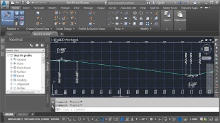
- Civil 3D makes it easy to analyze the volume between two surfaces using the Volumes Dashboard. That being said, if you’d like your earthwork to be a little more “visual” you can also highlight cut/fill areas and depths using custom styles. In this session we’ll explore how to colorize cut and fill areas using a custom surface style. In addition, we’ll look at how a label style can be used to identify the depths of cut and fill throughout a site.


You are the best instruction i have found.
they need to pay you more : )
I have autocad 2021. Everything described still works without any significant deviation. Life saver.
Yes it is
Thank you Jeff! Your videos are always my go-to for quick and easy Civil 3D learning!
Thank you so much!
I swear, every video is a new eye-opening experience. Great job, JB!
Yes it is
Thank you Jeff. As always an excellent overview. Thank you for helping us all learn.
This was a great video. Very detailed and quick. Thank you so much for making this!
Another great video from Jeff! thanks for always making my day to day tasks alot easier.
You're welcome! Thank you for your support.
You words are pure gold Jeff
Jeff, you just getting everything right and clear. I like the way you talk, very professional voice a plus.
thanks !
I appreciate that! Thank you!
Yes he us nice
Amazing Video Jeff! Thanks for sharing!
Great video. Good style of conveying. To the point, very clear, precise and informative. Thank you.
Thank you for the kind words!
Yes he is great
I've been trying to do this for the last 2 days, thank you so much
Glad I could help
Always to the Point! No fishing around and very effective!
Yes it is
Jeff makes everything so easy!
Excellent! thanks for posting it.
Great video Jeff, Thanks a lot
thank you, i always learn from you mr. jeff
Great Video! Thanks for sharing!
Great video Jeff...
Very nice Jeff!!
Thanks
The Kind of content I signed up for .. 💪🏽
Muy buen video Jeff!. Saludos desde Chile
Great video, Jeff. Thanks.
Glad you enjoyed it
Civil 3D wouldn't be such a powerful tool if you didn't explain how it works, in your way and style, witch is by the way excellent. Calm voice, deep understanding. Thanks a lot.
Thank you so much for your kind words!
This is a GREAT video. Thank you so much! Subscribed!
Thank you so much! You made my day!
Me also
You always get a lot of work done in 8 minutes! :)
Thank you!
Hahha yes he do
Great, informative video. Thanks Jeff!
Glad it was helpful!
you are a ture hero for me you make it look very easy thank you Sir
Wonderful video Jeff
Dude this is awesome! Quick and filled with info. 10/10. Would be cool if you had a link to the drawing so we could follow along
Jeff, This is Perfect!
Dude, Jeff...you are the MAN!
Thank you so much for your support!
Hmm
keep coming back to this whenever I need a cut fill exhibit. Thank you. great content
sorry to be so offtopic but does anybody know a tool to get back into an instagram account..?
I somehow lost my password. I would love any help you can give me
@Miller Odin Instablaster =)
@Ulises Saint thanks for your reply. I found the site on google and Im trying it out now.
Takes quite some time so I will reply here later when my account password hopefully is recovered.
@Ulises Saint it did the trick and I actually got access to my account again. Im so happy!
Thanks so much you saved my ass :D
@Miller Odin Happy to help xD
It's magic ! Love it thanx Jeff !
My pleasure!
Muito obrigado, ótima dica
Sucesso
Thanks, excellent information.
Success,
Amazing! Thank you.
Glad you liked it!
Great tutorial going to make life quicker well done
Thanks Matt! Glad it helped!
Yes he is nice
Thanks from myanmar,I am new to Civil3D
You are welcome! Thank you for your support!
Visit my channel to get complete course
thank you very much
Oh god you are great,man
Keep going 😊
Thank you so much 😀
Is there a way to create a dynamic table that displays volumes in the drawing? i am aware of volume dashboard, but it doesn't seem to be able to produce a dynamic table i can put in the drawing?
merci papa! tu ma bcp aide
incredible!! Thanks
You're welcome!
I enjoy your videos very much. They are very helpful. This cannot be called "earthwork" because the proposed comparison surface FG elevations consists of pavement, concrete and base course structural thicknesses that are being included in your volume calculation. Earthwork should be a comparison between a stripped EG surface and the bottom of the proposed surface structural sections (top of sub base). .I only mention this because this is a lack of capability in Civil 3D that has needed to be addressed for years, and hasn't as of yet.
Frederick Ernst yes I use trimble business center HCE for all my volume calcs its very good....i think cad has a way to do sub surfaces...with corridors and pay items but TBC is just so easy....
There is a way to get the earthwork to the bottom of the base. You have to set up a comparison surface. I do it all the time and have areas that are parking stalls with a different thickness than the drive aisle. It's dynamic as well where I can change the thickness of the pavement and it will update the earthwork. Civil 3D can do it, you just have to search. It's a very powerful program. Powerful, flexible and easy to use don't typically go hand in hand.
Thank You
You’re the man
hi Jeff.... Can you make a video about how we can create a label for Cogo point group to show elevation difference from a chosen surface underneath it for all the points in that point group on the screen ? Or at least can you give me the instructions to make it because it is kind of urgent...Thanks for your effort to prepare all of these wonderful videos about civil 3d they brighten our days ...
Nice video
Thank you so much sir you are awesome
You are welcome!
what about including cut to bottom of datum? do i need to add that to my corridor surface?
You rock!
Thank you Travis! You made my day!
hi sir jeff, instead of having color filled surface by elevation, i wanted instead by coloring contours only by elevation.and for label elevation i want to expand it to not more than 3 colors only but instead to have colors based in contours different elevation..how to do that?please help me with it..thank you very much..
thank you sir!
You are welcome!
Is there a way in Civil 3d to save your cut fill exhibit analysis color scheme to use with other C3d designs? That would be handy.
Is there any way to extract a boundary around a surface analysis objects for example around the cut and fill areas of a surface?
How do you account for knowing that the cut areas in the parking lot need to be deeper due to the materials being imported to create those profiles, can you create a cut fill map based off of the expected subgrade surface of a civil site? i.e. true earthwork cut fill?
thanks
Hi Jeff I have data short cut a civil 3D alignment, surface and profile info to a new file everything works but the profile they would not come up. Could you shed some light on this issue if possible
Another great video Jeff. Do you know if it's possible to increase the vertical scale in object viewer so smaller elevation changes are more visible? I find that these small but important vertical changes are especially hard to visualize when viewing a large area in object viewer. Also it would make finding possible errors in a surface much easier to spot.
Thanks for taking the time to create all these great vids.
Hi Steve, Vertical exaggeration of a surface can be done through the style. Select your surface, right click and choose "edit surface style". (Or create a new style) In the Surface Style dialog box, select the Triangles Tab. From here, change the Triangle Display mode to "Exaggerate Elevation". And then assign the scale factor of your choice. Surfaces having an exaggerated vertical scale will display exaggerated in the object viewer. Hope this helps! Thanks for your support!
Couldn't have helped more! Thank you sir!
Steve just Steve this helps as well thank you!
Jeff, Thanks for the video. Question, 5:32 how do you adjust the the location of the grid basepoints after you set them? I didn't click far enough over so part of my surface doesn't have surface labels.
Thanks Jeff, one thing - I was expecting to see you change the formula of the spot level to upper elevation - lower elevation but this was not done. How is the depth deduced by this spot lv? Are elevations removed from a volumetric surface & replaced with depths?
How can I draw Cut and Fill Line in Plan During Highway Designing as MX Road.
Thank you
You're welcome
Thank's for a great video! But why don't you use the Cartogramma Utility for this purpose?
Is cartogramma is easy to learn?
2:50 i dont understand how do you get max and min of elevation that you mention, can you explain it in detail?
How to edit the grid after displayed. Let's say I want the grid to be changed to 10' x 10' instead 5' x 5'?// Thanks
Hi jeff , i am facing aproblem it shows surfaces donot overlap
What if we only have pdf files for existing condition and grading and pavement plan?
Hi, can i ask how you insert your proposed level? I see yours have a 90 degree verticle drop ( probably kerbs) and im having trouble adding those in civil 3d. Adding those as lines would make multiple duplicates with different elevation at drop location.
Anyone know how to have the cut and fill automatically create and include slopes for cut and fill calculation outside of P-Lot Boundary?
Hi, I have this problem, hope you can help me. When i change heigh text value many times then i click "eartkwork plan production" icon, civil 3d immediately crashed. I uninstall civil, window,... but it won't. What should i do?
Great >>>>
Thank you!
every time I enter the spot for the upper right corner from the grid square, it just sits there and freezes up. I even did a fresh reinstall of C3D and it does the same thing. Any idea what I can try?
were you able to find a solution ? Be sure that your screen is rotated where the north is UP. this is how Civil 3d understand " UPPER RIGHT CORNER"
why for the cut and fill does not need elevation
Hi, how were you able to know the max elevation of cut and minimum elevation of fill? On the surface properties ranges, does "0" means no change? Is it relative elevation based on the base surface or is it absolute level? Thank you!
EDIT: Now I think I get it, it's because the TIN volume surface elevations represent the difference of elevations. 🤦♂️😅
When you create a volume surface, the elevations of the volume surface represent the “difference” between two surfaces. 0 means no change. Positive elevations reflect fill and negative elevations represent cut. Hope this helps!
@@JeffBartelsCAD Thank you Jeff!
" This is the message I get whe I try placing the grid box: The specified point was not a valid upper right point" any idea?????
Check your north orientation...sometimes CAD considers "upper right" as the northeast corner. Lol I'm assuming in the last 2 years you already figured this out, but just posting this in case someone else is having the same issue.
i am having an issue where when I finish up it only shows the elevation of my surface and not how much I need to excavate, can someone help with this? thank you
You might by chance be applying the surface label to the wrong surface. Make sure you are selecting your cut & fill surface.
HOW DO I DRAW EMBANKMENT LINES IN CAD MODE OR BY USING CIVIL DESIGNER WHICH EVER ONE IS BETTER
How to delete the labels on the grid. I selected all and delete . do you have better way ?/
Jenin Nadi Hi Jenin, I would recommend assigning a unique layer to the label style and then toggle the labels on and off by changing the visibility of the layer. Hope this helps!
When you did your expression you made the text 0.008 instead of 0.08 but the text seemed to increase after you added this expression! The reason I noticed is my text came in gigantic even tho I set it to the 2mm in my expression. Confused haha
I answered this question for kaackster. Please see my response to his question. Hope this helps!
@@JeffBartelsCAD thanks
why is the text height .008 when in the style dialog it's .08.
It's approx. the difference between decimal feet and decimal inches. When manually entering a text height in the style dialog box, the dialog box assumes you are entering inches. When the value comes from an expression, the dialog box assumes you are referencing the drawing units (or feet). Since I didn't require precise text heights for this exhibit, I just added a "0" (.008) rather than calculating the actual conversion of .00666666667. (If you watch closely, you'll actually see the labels get slightly larger after I apply the expression.) Hope this helps! Thanks for your support!
thanks for the reply Jeff. You always do a fantastic job with your videos.
you are showing drawing in feets in countours but how to change the drawing in meters in contours - please send
How do i show the cut area outline?
can i get a video link for food lot grading above
Can you share your earthworks style pls
dud why you dont put the link of the projetc to downlaod
Yes please
how to edit expression? where the tab to edit that?
I want report about the is