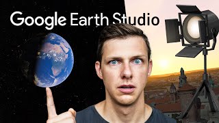
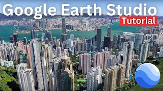
Create Drone-Style Videos for FREE with Google Earth Studio

Vložit
- čas přidán 14. 06. 2024
- In this video, I'll teach you how to use Google Earth Studio to create amazing, drone-like aerial videos that will take your projects to the next level. You'll learn the essentials like setting up keyframes for smooth camera paths, adjusting camera angles for dynamic shots, and controlling speed and altitude for that realistic drone feel. Plus, I'll show you how Google Earth Studio lets you explore any location on Earth, opening up endless possibilities for your footage.
Try Google Earth Studio: www.google.com/earth/studio/
Chapters:
0:00 Introduction
0:41 Quick Starts in Google Earth Studio
2:37 Layout, controls and views
4:00 Adjusting flight path
5:59 Adding and adjusting keyframes
8:18 Adding more attributes
9:46 Render footage to MP4
11:45 Start from a blank project


you have no idea how grateful I am to the way you presented the topic of this video. You used precise and to the point words and sentences. You didn't not try to make yourself clever like my CZcamsrs by adding too much fillers and saying to many irrelevant information. thank you. great educational video!
I suddenly got this video on my CZcams homepage. thank you
Simply amazing! Thank you very much for this presentation.
Wow cool vid!!!! Never realised we could render/download fab shots like that! Thank you! ❤
This is a fascinating tool I was unaware of.
Many thanks for the superb tutorial, you have some of the absolute best instructional uploads on YT, always thorough, always clear and concise.
You're very welcome!
Thanks for your clear explanation and valuable analyses here!
Beautiful, beautiful. Thank you so much for you simplicity. That’s all I need, straight to the point. You have a new subscriber 👍👍👍
Absolutely brilliant presentation. Learned the process and got the download of my project in my gmail within half an hour
Great lesson, ones looking for map animation globe animation use..must watch this highly recommended 10/10
So amazing! It’s been some years since last creating these and now this is Next Level!
I'm excited about all the possibilities with using this. Thanks for such a thorough discussion. Jim
Glad it was helpful! I really had fun trying it out.
Exactly the instruction I was looking for. Thank you!
WOW! This is a Great Lesson! Sometimes, It's very difficult or almost Impossible to fly your Drone, Ex, Rome, Italy! I will Definitely try this!
Been waiting 4 days now!! Great video thanks
Thanks! Hope you get access soon.
well detailed and well explained. thank you!
This is exactly what I was looking for. Simple easy to follow tutorial on how to use the Quick Start settings which, IMHO, are sufficient for the average casual user. Most other tutorials are too long, >30 minutes or sometimes > 1hr, and dive deep into advanced tips & tricks even though their video titles imply they're for beginners. I always prefer these short KISS tutorials. Thank you 👍.
I happy to hear the video helped you out.
@@TeachersTechout of all the comments, why did you choose to reply to this one?
I see several dozen comments, and very little reply’s on your part?
Strange!
People take the time to watch your videos and watch the video, yet you RARELY reply to these people?
Again, strange!
😊😊😊😊😊😊😊😊😊😊😊😊😊😊😊😊😊😊😊😊😊😊
WoW another Winner Video Jamie - that was Awesome !!!
Glad you enjoyed it! I had a lot of fun playing around with this and was excited to share.
Thanks and thank you google as well!
Great video thank you! 🙏
"Path to creativity"❗
Thank you so much, dear host, "Teacher's Tech " ! 🙏😊
Your efforts truly assist us in understanding the big picture, and we are grateful ! 🙏🔍👏
Thank you. This was VERY helpful.
This is fantastic. Thank you 😎
So awesome! Thank you! Subscribing!
Awesome tutorial.
Excellent thank you.
Nice video thank you for sharing
Superb Tutorial of goole earth studio it is helpful for everyone thnaks again
Wonderful ! thanks for sharing..
ty thats awesome
Super, super vídeo!! Thanks a lot!!!
Fabulous. Thanks!
Amazing
thanks a lot
Thank you so much for sharing this video with us My dear.
great vid
Excellent video...this is totally new concept...thanks for sharing
Glad you liked it!
Thank you!
Very nice
This is great wow
Great video ❤❤
Great video, thanks for making this!
Glad you enjoyed it!
any way to change the altitude from 'meters' to 'feet?" Going crazy looking for this setting ..... thanks.
I don't see that option. I'll explore a little more.
This is great 👌😊
Thank you! 😄
good job
Wow, thank you so much for this great, very easy to understand tutorial! Kind Regards, Tom Pollock
You're very welcome!
Thanks for the excellent video. It will be worthwhile for teaching. What will be maximum length for rendering?
That video just got you one new subscriber. I never do this, but this time, I will also hit that bell.
Thank you!
Teacher's~super- very insane job-:))
Thank you 🙏
nice👍
Great video. Thanks. But how do you grab hold of the white dots to edit the path? I can't get hold of them. I'm using Chrome on a Mac.
Subscribed!! Thank you for this amazing tutorial. Anyway to make paths or routes in this app? I’d like to make a motorcycle path as longs as we ride between cities. Animation maps I guess with the paths. Thank you again!
Luar biasa bang
Is there an option to "fly" over forests, deserts, rivers, islands and create nature look footages?
Thanks for sharing this video. Question: who owns the copyright of the downloaded mp4 video? Thanks.
Still it can't replace the drone for actual footage where there are people and cars moving
Wow, but pl let me ask this, is the google camera view ALWAYS a live view without hesitation or sort of stored video?
For subtitles, be sure to incorporate Immersive translate. It is a free revolutionary software that generates video subtitles effortlessly especially to help the foreign audience.
It might be a cool idea but in my opinion a real drone Video is much more better and quality wise there definitely is a huge difference existing.
Easy as 1, 2, 3
Definitely!
Fiine work. Is there any way to adjust the speed, e.g., rendering in slow motion? Thanks.
You can do this when editing
Very good video and you made great effort
But unfortunately, it is not working
Any advice?
great video! how long does it usually take to get approved to use GES? It's been 4 days since I signed up.
nvm. got approved yesterday. thanks.
Thanks for sharing this. I've got a question. Is this done on a computer or it can be done through the app on a phone?
You're welcome. I didn't see an app for this, just through a browser.
@@TeachersTech Thank you so much. This will be a game changer and glad I know now👍
GREAT video and presentation, in every way! thanks!! sub'd/liked/FB-shared :-)
I love it. Although, the pictures look a little like AI.
Right now, they don't license the service for commercial use. Is this likely to change?
I bet avenger is also using this tool from embedded source..my guess.
can I cause any copyright issues?
That should be a threat to national security lol seriously 😳
Nice video on drone like footage! Can you upload the Google Earth Studio drone-like aerial videos to CZcams?
Yeah but you can't legally use it for any commercial purposes.
Super Idea. but trying it out gave me a lot of frustration because google earths data is obviously even much older that google maps data - which often is not the brightest of the shiny new things. But if you go e.g. to Amsterdam Zuidas, there is buildings that were finished two years ago from now, had a building time of 3 years and are not even begun to beeing build ob Google Earth. Well yes the colloseum in Rome would be a miracle if they hadn‘t that ;-) But for newer stuff they seem to let their data rott for a while before updating it.
How long did it take for you to get a login permission ...Thanks
Done one of Tower bridge, London which is great, now I'm zooming into my home town but the buildings are 'flat' ? at least I get 3D buildings in Google street view?🤔
I guess Google have less definition in some parts of the world ?
Why are they flat?😳
You said it yourself. Google has less definition in some parts of the world. Everything is based on 2 dimensional photos. But for some locations they apply the extra special techniques that can make 3D projections from their collections of photos. Apparently the difficulty of doing that has required them to prioritize the most frequently viewed parts of the planet. Maybe they will add other locations over time.
😮😮😮
can i use these videos for monetization in my facebook page?
How do i upload music?
Hey why is my google earth studio rendering al the buildings in 2D and not 3D. Everything appears flat. Pls help
thanks for creating this video - i can not find a map by using multi view
just now i found it 😀
How do I get current view? This is several years old...the view is..
can I monetize youtube video google earth studio commercial
Can I use it in youtube without copyright
This is what they say: As long as content created from Earth Studio is properly attributed, it can be used for any application such as research, education, film and nonprofit use. For more info: www.google.com/earth/studio/faq/#:~:text=Who%20owns%20the%20content%20I,Earth%20Additional%20Terms%20of%20Service.
If i make videos frome that on you tube . Is will be acceptable on you tube monetization?
You can't use GE for commercial purposes.
can`t use in my country
IMPORTANT NOTE: To avoid potential copyright strike, you aren't supposed to crop out, or obscure the attribution (as in the Intro to this video). "All uses of Google Earth Studio must provide attribution to both 'Google Earth' and third party imagery providers, if applicable. We require this attribution to be visible when Earth Studio content is shown."
On top of that, you can't use GE at all for commercial purposes, attribution or not.
Google studio is only allowed on a case by case basis. If you don't have a good reason you can't use it....
Why does mine look so blurry?
so can we upload these drone videos to youtube and then make money on there from advertisments?
I believe you can if you use proper attribution, plus leave the watermark on the video.
Drone-looking? Do U have tomatos on your eyes? 😂
This is web based I believe?
where?? in 5 cities in the whole world?
Can you remove the google tag of the footage?.
You can crop it out if you want to break copyright law.
if it's copyrighted by Google Earth, that would result in a copyright strike if uploaded to youtube, or so it would seem.
Not if you give proper attribution, including leaving the watermark on the video
I'm no expert on the matter but I would assume that sense Google Earth has literally created a studio for creators to make videos that it would be okay
Doesn’t Google own CZcams… so why would get a copyright strike… I would not want to use any water mark on video not professional.
Have you read this?
Powerful motion design, all in the browser. Earth Studio gives you the tools you need to create professional content with Google Earth imagery.
Makes no sense bro ur an npc. This is actually a good maps system with animation, not a lot of alternatives.
This is not working in every country because it has only set of images from western countries even You search for Australia places it is distort images ...
Not 3D building
Google has archived all public streets so Google has proven trustworthy with public spaces.
Too bad it cant be used for my real estate business... no commercial usage
Hope my channel will be monatized after fulfilling the certain criteria. 1000 Subscribers and 4K watch hours.
You need a gmail account and I don't have one. Also, I am never going to have a gmail account
Thank you kindly for letting us know that, sir or madam.
@@Liminal-Mystic 👍😂
looks cheesy choppy and fake, no thanks. fyi, anyone can figure this out.
ඔය ගොඩක් කැගහන උන් අනිවා ජාන කලවම් එක්කො අතවර වෙලා එක්කො බඩුවක් වෙලා එක්කො වටේම උන් ටොකු අනිනවා ඔය ඇරියස් තමයි ජාතියක් ආගමක් පෙන්න බැරි.ව ලක් අම්මායි සන්න හුන්නයි වෙන්නේ හිගන පැටවි🤣🤣🤣🤣
Does it Cover Each And Every location and Region on The Globe ?