Navigation - Geographic Range

Vložit
- čas přidán 22. 12. 2014
- Capt. Dave Medeiros explains how to calculate Geographic Range, which is how far from an object you can be and still see it.
Looking to become a licensed mariner or continue your professional maritime training? Obtain your training and certification with Northeast Maritime Institute. We offer on-site and online training for US and International seafarers. Visit www.northeastmaritime.com for more information.
Explore and subscribe to our CZcams page for more maritime content!
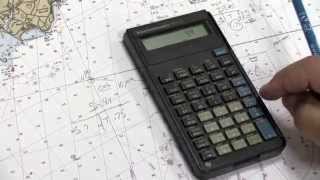
Navigation Plotting is an essential skill for working in the maritime industry. This video is an introduction to some of those concepts. If you've spent lots of time on the water, but have not pursued a professional license, you should consider yourself a candidate for an Operator of Uninspected Passenger Vessels (OUPV) 6-Pack license. This license allows you to charter vessels with up to 6 paying passenger and is the first step to a career in the maritime industry, full-time or part-time!
Copyright © Northeast Maritime Institute


These videos are helping me get through a poorly designed course. I will take my OUPV /6 pack course through NMI thanks to Captain Medeiros and his outstanding videos!
Thank you for your feedback!
just wanted to say thank you for your videos, I passed steersman school at Delgado community college in New Orleans with your help, thank you sir, you are a skilled teacher
We are glad to hear that the videos were helpful. If we can be of other assistance for classes / training do not hesitate to contact us
Very well explained thank you 😊
Great video, thank you for simplifying.
Don’t forget to allow for state of tide as heights of lights are above MHWS and you will likely be below that, i.e. closer when the light first comes into sight. But wonderful to see the light change from a loom to a light 🙂
so if MHWS Is 5 metres and Heights of tide is 3metres and Height of eyes 2metres above water level i will be same height than MHWS and see the light at the same range than nominal range??? just checking if I understand
Correct @@francoismacaire2427. So...
Height of light = 30m (above MHWS)
MHWS = 5m (over chart datum)
Current state of tide is 3m (over chart datum), i.e. 2m below MHWS
Your height of eye is 2m over height of tide, i.e. height of tide + height of eye = 3 + 2 = 5m
So, as you say, your eye is at CD + 5 = MHWS and so the height of light from your observation is 30m ... just as you say 🙂
@@iainhunneybell thanks for checking! appreciated
thankyou capt. Dave
Thank you Cap
Sir Also By This Method We Check Geographical Range
GR = 2.095 (√ Height Of Eye + 2.095 (√ height Of Object In Metres
= 1.08 (√ Height Of Eye + 1.08 (√ height Of Object In Feets
Wow thanks. Is it the same as the charted range of the light?
Sir, height of object and eye from which water level? MHWS or chart datum?
👍👌
Strange that if I use my tables, combined height of eye & &elevation of object, that I get for those values 15.3'
Not so acurate if we'd want to plot our position on the card with that help. What's the explenation behind that?
I got 16.02 using the Geographic Visibility Distance formula. The video is correct but he is using tables.
Geographical Range = 2.095(√ht of object in metre + √ht of eye)
kindly do tell that why do we multiply by 2.095 when in metre and 1.15 when in feet. the values 2.095 or 1.15 where did they come from. pls do reply if possible. thanks n regards.
Good day dear brother Venu Gopal, me also I need the origine of That formule d=2.1(RACINE d +racine H)
GR = 2.095 (√ Height Of Eye + 2.095 (√ height Of Object In Metres
= 1.08 (√ Height Of Eye + 1.08 (√ height Of Object In Feets
Sir how about 18 feet sir what the geographic range?
💞💞a💞💞