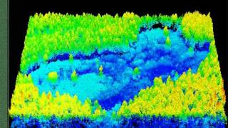
Treeiso: Accurate Individual-Tree Isolation from Terrestrial Laser Scanning (3D Lidar)

Vložit
- čas přidán 20. 06. 2023
- Discover the use of Treeiso, an algorithm that enables precise individual-tree isolation from terrestrial laser scanning data. Learn about the methodology, challenges, and key parameters involved in the process. Join us as we explore the process step-by-step, showcasing the practical implementation using the CloudCompare software. Enhance your understanding of tree analysis and gain valuable insights into the world of individual-tree isolation.
- Věda a technologie


Masterclass CloudCompare: udemy.com/course/pointclouds/?referralCode=E490A12C2CDF6F1A8D06
Machine Learning 3D: udemy.com/course/machinelearning3d/?referralCode=40101884598550D81951
QGIS LiDAR: udemy.com/course/qgispointcloud/?referralCode=C0475DD749B50F1FD408
Cours Potree 3D: udemy.com/course/potree3d/?referralCode=B665A8C0FC8E406EEF44
Cours CloudCompare: udemy.com/course/cloudcompare/?referralCode=7325CB8139D425C5BE73
160 LiDAR Quiz: udemy.com/course/3d-point-clouds-lidar-the-ultimate-quiz-challenge/?referralCode=A835D3ECD379D2798EA3
Cours 3D Complet: udemy.com/course/point-clouds-in-qgis/?referralCode=01B0A1513F5E08C65C95
Thank for sharing!
Very informative Thank you👍
Interesting!
Fascinating stuff, i'm a complete noob in regards to CloudCompare, can the "groupings" be stored in the laz, or be exported to a .ply? Maybe as vertex-colors. What i'm also interest in, is if its possible to tell apart decidious and coniferous trees, and also store this information into a file that can be exported.
How can I tell the program to separate the point cloud with the segmentation. Because right now its one point cloud with points segmentated, but i want each segmentation to be its own point cloud, so i can export them individually
Nice and clear video, well explained. I have also gotten your Udemy course, looking forward to learning more about using Cloud Compare.
For further forest analysis, structural variables from the trees are needed (volume, diamters, lengths). Using RANSAC I can fit cylinders in Cloud Compare, but it would be nice to have something like TreeQSM to reconstruct the tree in a model. Do you know if anything similar is available in Cloud Compare?
Hi nico, thank you for your comment. You can use 3DFin, a new plugin that comes with the last version of cloudcompare. It gives a lot of dendrometric information like diameter, axis, height... let me know if you need any help.
So Cool!! what is the module you had attached to the top of the drone?
Boa noite! Poderia me ajudar? O painel da caixa de propriedades da entidade não está visível, somente a árvore de entidades. Como faço pra tornar visível o painel de propriedades??
Olá, normalmente a caixa de propriedades fica visível o tempo todo, olhe na parte inferior para alternar da árvore de dados para a árvore de propriedades.
@@akharroubi Desde já, agradeço muito pelo apoio e intuito de ajudar mas, não está junto na parte inferior.
Tentei até mesmo reinstalando o software mas, não tive resultados...
Vou mais una vez refazer a instalação pra ver, obrigado!!
I tried using Treeiso for a plot of over a hundred trees, unfortunately I might not have had to filter the lower part to separate the seed as it might be ,now the isolation I have is not good because of the foliage and twigs intertwined, what should I do to get a good one ,thanks.
1. It is essential to separate the ground from the trees. Since Treeiso assumes that the point cloud contains only trees.
2. Treeiso is well suited to terrestrial laser scanning, but not so well suited to aerial applications.
3. Increase decimation resolution and regularization.
In general, make sure you have a clean point cloud, containing only trees. And play with the parameters of the 3 segmentation levels.
I want to isolate only the tree samples( eg:1m height) from taller trees (eg-10 m height), how to execute it, and can I find different tree species and coordinates points of each tree?.
Yes, it's possible to separate tree heights. But not on Cloudcompare, you can write a quick script for that. Here's what you need: once you've separated the trees on Cloudcompare, there's a field (final_segs) that contains the ID of each tree. So your script just needs to measure the height of each tree (max point) relative to the ground. For species classification, it's more complicated than using an unsupervised algorithm or a geometric method, I think you need to use a supervised approach to train your model on samples of your species.
@@akharroubi Thank you Sir.
Is there a good source that delves more thoroughly into the settings of Treeiso?
I'm making a new tutorial about it.
Great! I'm looking forward to getting it. Currently, my workflow involves randomly adjusting parameters without a clear understanding of their effects. I keep an eye on the number of trees it discovers, and once I approach my estimated values, I proceed with the next steps.
It appears that Treeiso is the only plugin effectively handling aerial LiDAR data. Unfortunately, 3dFin encounters issues processing drone material and consistently throws errors.
@@anttiv7109 Right, 3DFin is for Terrestrial data (TLS)
What about deciduous trees?
It worked very good for deciduous trees also, I will upload a small demo below.
promo sm 💪
😒 "promosm"