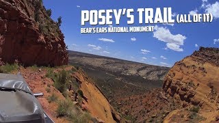
Onion Creek - Thompson Canyon Loop: From Desert to Mountain and back

Vložit
- čas přidán 22. 11. 2020
- This is probably one of my favorite day trips in the Moab area, starting off going up the fun Onion Creek but then continuing where most turn around and heading up Thompson Canyon into the La Sal mountains and Pine Trees and Aspens.
Once a scale of 1 to 10 95% of this dirt road is a 1 or 2. Easy enough for passenger cars. In a couple places in Thompson Canyon it reaches a 3, where 4WD is recommended. But just about any 4WD or AWD vehicle can make it, although it might feel a little adventurous in car based 4WD vehicle.
The entire length is on BLM and National Forest land so dispersed camping can be done once you're past Fisher Valley but if you leave Moab by 9am, you can be back by sundown even if you stop often to enjoy the view. The campground up in Thompson Canyon is remote enough that I wouldn't recommend it as an alternative "overflow" to Arches or Moab unless you plan on exploring the area up there. It's about an hour from any pavement.
Here's the KML file for the trip:
drive.google.com/file/d/1th3g...


Over the years, I've been in all 50 states, 38 countries, and 6 continents. However, Utah is my favorite!
This is a very cool drive. Yet another of those "close-in to where all the people are but far away from where all the people go" trips one can take in the area. I just spent a week there this May (my first trip to the area since 1966!) and was blown away by the incredible scenery. I was also amazed by the fact that just about every main road has little roads heading off into the wilderness that provide fantastic views and lead to places that are far less crowded than the general tourist sights. I'm going to have to schedule many trips to even begin to comprehend the beauty of it all. And can I just add that I love the "Guy with big belly leaning on the rocks" comment about that one formation. 😃 It's a perfect description. It reminds me of the "Old man dragging a heavy sack" that I saw in Valley of the Gods or the "Fossilized Star Destroyer" that I saw near the Hite Overlook on State Route 95. The things we see are in our minds, of course, and the dramatic structures all over southern Utah open windows to our imaginations. I just loved that about my trip. Thank you once again for your detailed reviews. They are helping me plan my return this year likely in late October or early November, to catch a different weather perspective on the place.
Your channel has the most informative trail videos on CZcams.
I was aware of Onion Creek having seen videos of it before. However, this is by far the best and most comprehensive I've seen. Very nice video. This is definitely on my to do list. Thanks.
We have ran onion creek a few times and still its one of my favorite trails along with chicken corners. Nice video
Thanks for all the trouble you’ve gone to while making this video. Very informative. I think i’ll make this one of our day trips the next time we’re in Moab.
Another fantastic video. I enjoyed it, as always. I really appreciate your straightforwardness and the helpful information you share.
Wow. Stunning landscape and an awesome trail.
You have no idea how happy I was to see Moab Diner at the end of your video. :)
Added to my Moab to do list! Thanks for great videos! Your audio game is 10/10 - drone video with stereo sound...very cool!
Great video. Fantastic footage! Thanks
You make it seem like we are driving right with you! Cool!
Outstanding videos and I’m long overdue saying THANK YOU.
Excellent video. I've watched several of yours lately, from old ones to new ones, and your drone video has really improved - some spectacular clips in this video.
Great vid. Thanks for sharing!
Hi. New subscriber here. Excellent photography. Very impressed.
Thanks for sharing, especially the geologic information. I've driven the first 11:45 , then returned the same way. Have to do the full loop another day. I also enjoy you photography, safe travels.
Utah is glorious! Great ride!!
We really enjoy your videos!!
Great video. Much help toward planning our trip. Thanks for posting. We will be respectful when we visit and leave the trail just as we found it.
That was some trip! Nice job capturing the journey. Looking through your videos, we have traveled some of the same trails. Thanks for sharing! 😀👍
Great information, Thanks. I'm hoping to check it out here soon!
Great video informative and entertaining
Awesome ride video👍👍👍👍
Thanks for a great video and some geologic info!
Thanks for the ride....on the “to do” list for sure.
Je suis Français, J'adore cette région de Moab au point d'y avoir été 20 fois depuis 27 ans. J'aime l'Ouest Américain et je trouve les américains vraiment sympa. Merci
J'habite le Kansas depuis 15 ans et je vais au Utah chaque annees. C'est vraiment un endroit que j'appele "chez moi"
May 7th 22 and I completed the trail in a Raptor. At the primitive campground location, that road has been completely washed out, leaving only huge boulders. Still went through it but it was difficult! The entire trail is washed out compared to this video, not an easy trail and definitely have a spare in case you pop over on a sharp rock.
Great video! I am glad I discovered your channel. I am getting a lot of good ideas for upcoming trips. These roads all look very passable with my Tacoma TRD Off Road. Thanks for showing your maps too.
Oh yeah with a Tacoma the sky is the limit for you. My big limitation now is that so many trails are geared for Jeeps that a fullsize truck is just too big. But Tacoma has more offroad capability and is the absolute sweet spot for offroading wheel base. I honestly believe that Tacomas are better offroad than a 2 door Jeep Wrangler.
I rode up onion creek with my dad, a Forest Ranger, in 1950. We visited D.L. and Coleen Taylor at their ranch in Professor valley. The road looks improved as we mostly drove in the creek with many places just wide enough for a Ford Pickup (2wd). Great contrast between desert and alpine mountains in just a few miles.
Iguana
Man, I love Moab. I’m going to have to try onion creek next time I’m out there.
If you haven’t, give the Kane creek trail a try. A little tight in places for your rig, but worth a try.
The way you cut your drone footage in is really nice. All the sat photos overlaid with the red route are nice too. Well done. 👍🏼
Beautiful 😍
Great video! Thanks!
i love this channel!!!
I watch your video of skyline drive this time last year and I ended up doing it on July 23rd. From state route 6 to mayfield. I think I’m going to have to do this drive late spring ish next year! I think I’ll do it as a two day trip.
We were just in Moab for teh first time. We ran Onion Creek but didn't go through. Next time we will need to do this. Loved Moab!
Thanks for this. My 9 year old twins are stoked for a trip to see dinosaur foot prints
Gotta say way good, all good. Really enjoy your presentation, knowledge of the terrain and most of all your topographics which I believe give your videos a step up above all the others, makes them way more illustrative. Have been watching these Out West, back trails channels and vlogs for a couple months now and insist your sites, where you visit, is really hands above unique and more fascinating, edge of my seat stuff. Have seen 4 so far all top notch in every respect: Your Onion Creek was best till viewed Thompson Canyon - really wanted you to visit those primitive camp's too. Saw Skyline, Dragon Canyon and Grand Staircase, each one better than the last. You give a level headed description, but best of all you don't go ape shit and scream for 4-wheel drive every time you see a rock in the road. What is very best is that your vid's are all from the front seat, the same way I go about locating good backpack trails, landscape visits and places of interest I want to get to on foot. For that you get a big fat WTG! And thanks, very enjoyable.
Fantastic narration. We did onion creek,but not the loop from onion.Previous year,did loop from Spanish Valley entrance area. And somehow ended up in Paradox Colorado.
Loved your video. We drove up Onion Creek one year and turned around. Wish we had don the entire loop. Just so many laces to explore out there. Cant wait to get back....
Another favorite Moab ride. We saw a huge elk herd on Polar Mesa the last time we took that trail in early spring with lots of snow.
That's awesome! I see deer all the time but it's so rare to see much elk. I don't think I've ever seen any south of the Uintas, I'm actually amazed there are some here.
@@exploresouthwest We were amazed as well. It happened so fast I couldn't get the big camera out in time. Here's the GoPro footage if your interested. Go to 13.57 to see the elk. czcams.com/video/dfm25wPCGXg/video.html.
Just ran this a few weeks ago. Your video turned me on to it. The switchback at 14:00 is rutted pretty bad. Trick is to turn left then back down the switchback and drive forward out. Very pretty drive but plan some time. It took awhile 3-4 hours before getting back into Moab but well worth it. Dinosaur tracks back up top too.
That U-Haul reminded me of a time that me and my son were out on. We took out the Outback that day and headed up top. It was a deluge that caused mud to move. We knew that the last creek crossing on the way back was going to be rough so we were rolling pretty good. On a section of downhill we see some headlights right about dark. It was an old minivan on the uphill so we gave way. He pulled up with a look of just scared and asked if there was a way out uphill. Me and my boy were like, nope, not today. He was totally lost too and just wanted to get his family back to pavement. We told him about the rain and rising water and told him to follow us out. We get to the crossing and my boy checks the depth and says we gotta go. Told the guy to follow my lead, slow and on a angle. Nope, he freaks out, floors it straight ahead. We felt so bad for the guy when we saw that thing just smoking. Pulled him to the road, that's all we could do and they were so thankful. Lesson learned is that some vehicles don't belong out there. Could be the best day ever, and 10 miles up it's crazy and you get into trouble.
Great video man.... we going to utah for our honeymoon and i wil try this trail...
Love it
Nicely done. Love it out there. I took that route the opposite way when I was taking the Rimrocker Trail from Colorado. It usually doesn't go that way but I didn't want to go into Moab so I went through Onion Creek. Depending on how much rain that area gets you have to be careful around the top where the ranches are...where it levels off...that flat area can get extremely muddy and rutted.
Is this a seasonal issue? I'm wondering if the weather in early April would affect this route. I'm going to do Onion Creek and would really like to check out that Hideout Camp if possible.
@@R3LF13 Depends how much snow and subsequent melting snow they get but I think April it would be fine. You'll definitely be able to assess the trail as you go. It won't just be an all of a sudden thing. I was out there in March and except for a couple places it was fine... And there was melting snow in the area at that time.
@@NigelNaughton awesome. Thanks for the reply. Really looking forward to Moab. So many things I want to do but only so much time. This route is on my list though for sure. Thanks again. 👍
@@R3LF13 You are welcome. Depending on what kind of vehicle you are using there's endless things to see. Here's an awesome place to go with no people and endless views (85CFMWG8+CW) You can get there from HWY 313 (towards Canyonlands Nat'l Park) on going past Lone Mesa Campground. All BLM land out there. Have fun!!
@@NigelNaughton thanks! I'll search those coordinates when I get home tonight but based on that description I'm guessing that this is the hell roaring area? Funny enough, if thats right than thats exactly where I'm planning on going next.
Wow well done. Beautifully crafted “dirt” road trip report, I love the 3D map animation. The scenery is amazing. The recording is seamless, well paced, the narrative is right measure and the whole report is never boring. Could you add a map of the itinerary at the start of the video, to put the trip into perspective? Again, well done. I am watching now all your other videos!
Well done. I'm missing those late summer/early fall days already.
Next time you're in the area, check out the Dolores River Overlook in that area you said looked beautiful but never explored. It's a great ride and great place to camp before you come out.
When I got home and was looking over maps of the area and saw that. Like I said that part of the map is a blank area to me so finding some places to go while wandering around that area is definitely something I need to put on the list for the future.
Great video- very informative. Had music but it wasn't obtrusive. One other tip to share might be that the edges of those drop offs can be very wet 1/2" underneath even very dry dirt. That is why it is not recommended to walk or ever drive too close to the edge and especially if it has any slope to it. You can hit the brakes but the truck can keep sliding on that layer of red mud.
I'm planning to run Onion Creek soon (Jeep.) Coming from town, I think we will enter from rt. 128. We are planning to hike Fischer Towers and also head over to the Bull Canyon overlook from Castle Valley so time is a premium. If you have entered from that directions, how many miles into Onion Creek do you think will get us the main highlights before we have to turn back around? We want to spend about 2 hours in the Canyon. It looks like it splits (left or right options) after the creek stops around mile 7. Is that a good turn around spot- if not, should we go left or right at that point?
Thanks!
I am proud of being the number 1k like😅
Nice road views and mapping you did. I wonder why you called out a single track on the side of the dirt road and tied it to the group you passed, stating that they were going off trail but then you yourself also went off road to turn around and also to explore in places big enough for your rig to go...off trail. Are you against motorcycles using the back country the same as the 4 wheelers do?
Great trip.. looking forward to more.
Thanks for sharing your trips. You're a great storyteller. One question if you don't mind. What rack is on your truck for your tent?
It's the Thule Xsporter Pro truck rack.
i spent a stormy night under that shelter back in 2015
Curious if you think pulling a 13’ teardrop trailer behind a Tacoma Off Road on this route (no paved sections of course) is doable? It has an offroad suspension and the trail doesn’t look technical. Wasn’t sure if there were any crazy hairpins to be leary of? Thanks. Great video.
Awesome!! Why you alone? I would love to go.
Honestly it mostly comes down to just having weird days off and spur of the moment decisions to use the time. Some trips are made up just a day or two before I go. 3 days off mid week so I throw everything in the truck and go.
Tried to find the second part of the trail, after Onion Creek in AllTrails, no success. Any advise on how to create a navigation map of this trip?
Thank you, excellent work
NP
I put a link to a KML file in the description that can be imported into Google "My Maps" Google Earth, or GaiaGPS. Usually I see the upper trail referred to as Thompson Canyon.
I am planning a back road trip to Moab in February, I have questions . Is there a way to email? Awesome video, added it to my list of days. But still have questions.
Wow, what a fantastic drive. I've found it on Google maps but is hard to follow your route on there. I can't figure out how to use the KML files. Do you by any chance have this in a Google map file or can I access it via some other medium? Thanks so much for sharing your great experiences in Utah. I love the area.
I don't know of a way to just a have a google map available that can also have the route be downloaded for other formats (I need to do more research) I do know that the KML can just be dragged and dropped to Google earth, or GaiaGPS, or imported into Google My Maps. At least until I can figure out a way to better provide the route links.
@@exploresouthwest I just downloaded GaiaGPS so I might be able to use that to get your map downloaded. I did find your route on Benchmark Maps Utah Atlas. Benchmark is so much more detailed than DeLorme. Thanks for replying. Let me work on it from this end.
Utah benchmark atlas has these roads on it
For me, the trip was amazing! But you left out a very important item. How far in mile it was. I want to repeat your trip on two wheels, so fuel/milage is a concern
How long did the ride take you? We are planning on doing this in September
It's always longer than I think it will be. It's hard to put a time on it depending on how many stops you make but I'd definitely count it as a "half day" or "3/4 day" trip. It won't be sunrise to sunset, but it will be the main thing you do for the day.
Sir, can i go from la sal to the bull canyon overlook passing forest road 4666 and then fisher creek 4005 to go to onion trail? In a sprinter mercedes 4x4? Wou,d appreciate feedback
Beautiful scenery! My favorite area on the planet! Question...how do you get the red lines on your maps that show the roads you took? Is that in Google Earth? Google Maps? Something else?
How many miles is that roughly? And how much time did it take you?
Can UTVs use the roads traveled in this video? Btw great work on this thanks
Yes, in fact they middle part of the route probably has more UTV/ATV than full size vehicle use. Trucks and SUVs are a bit bulky and unwieldly.
Would this road be doable in a Subaru Crosstrek?
Are there plenty of camping opportunities along the way?
Yes, but one you head up onion creek theyre all primitive camp sites. All the organized campsites are along the colorado River.
How long did it take you to finish this loop?
How many miles is this lo ?
I think it was about 60 miles. Offroad MPG is much worse than highway or city, but if you gas up in Moab before you leave you'll still have plenty of leftover gas at the end.
Is your Tundra stock? I am considering buying the same era Tundra with 4-wheel drive and would like to drive down similar roads, just wondering if I should plan on doing any suspension or tire upgrades. Thanks.
Yeah, but my shocks needed replacing so I got some Bilsteins the TRDs use. And the tires are upgraded to BFG ATs. I keep meaning to get some strong rock sliders to protect the door jamb and give me something to step onto when getting in but never can seem to find the money for it.
Great video!! Thanks! One suggestion...the “narration” is better when you do it as an audio “overlay” over top of the driving footage/drone footage, rather than “selfie video” of you walking around talking to the camera. Just sayin. And thanks again!
Are there any animals to look out for????👍😉🇳🇱🇪🇺
Ravens. And more ravens.
Is it easy for a Jeep
Do you need any special pass or permit?
No, it's just a BLM track. There are some private lands bordering the road in places to the usual good behavior stuff is all you need.
No idea from you description where the starting point is. Where do we find it? You posted some kind of file kmz no idea what that is. Does not open with anything I have
It starts at the Upper Onion Creek Campground. Other trail sites online refer to it as "Onion Creek" if you need to search a different track route file.
Great video. How many miles is the whole loop?
I think it was about 60 miles or so. Easy on 1 full tank of gas, but the slow going makes it a half to full day drive depending on how much you spend on looking at scenery.
The music what is it please
I got it from Audio Jungle. I think it's just titled "Acoustic Corporate Kit" in the motivational section.
No....... more people don’t need to know about it. I’m greedy
Not your private playground.
Perhaps the guy you assumed was hunting was target shooting .
Wash your truck when your done the Creek is full of sulfur and salts and acids great drive but make sure to wash your undercarriage after
Ok, I'm done with your commentary about others, I'm gone!
Yes he sounds like a californium.....
got tired of the music
My understanding is that you shouldn't drink from Onion Creek, even if you do treat it.
I think that's very good advice. And probably true for many waterways that wash through the naturally occurring salt deposits and former uranium mining tailings in the area...
Best to pack in your own (if possible).
I'd agree. A filter ONLY filters out sediments and organisms. Even boiling will not take out toxic substances, heavy metals, etc., that are dissolved in the water. You could DISTILL it, and drink that water, but you'd now make your distiller toxic. Also, if there is uranium in the water, you DEFINITELY don't want to drink it. Alpha emitters aren't good in general but are relative harmless outside of your body. INGESTING them, though, is the WORST thing you can do, and can lead to cancer and death. Just don't.
Great video! Did the exact same drive a month ago (April '23). Still a bit of snow left once you get up in elevation. czcams.com/video/PXDMUlLqevs/video.html
This is Blm NOT NPS. It is maintained more primitive. Dont think about turning into a park.
What are you doing, man? Take this video down immediately! We don’t need more people driving this trail. It’s boring, it’s long, it’s hot, there’s absolutely nothing to see, just rocks and more rocks, like all of Utah. Stay away, everyone, just play your video games at home!
Not your private playground. I am planning a trip to that area solely based on this video and I will shoot video and share it and tell as many people as I can how fantastic it is and that they should go. This is America. If you want to keep people out then buy it. Otherwise move over because I’m coming.
@@markkiger5219 Awesome - see you there! Have fun…
@@markkiger5219 it's called sarcasm...
@@markkiger5219 Don't be a self-righteous douchebag. I've seen any number of great sportbike roads ruined with squids and cops because they became popular, especially over the internet. I'd rather see these roads/trails stay less travelled and found only by people taking their time and searching them out so they don't get destroyed by too many people. But, I guess you're just going to be a douchebag and be responsible in part for the destruction of these trails. Congratulations, great job.
So, lets not be so critical about what other people do. Talking about the bikers, you don't know the cercumstances or permission they may have had!
BLM doesn't give permission to ride off trail. People destroy the plants and soil...then, blm wants to shut things down. Get ur facts right. Stay on the trail
@@jasondevereaux3369 Well, I know many ranchers that "lease" BLM ground and use ATV's for the ranching activities. Maybe you should not make overly broad statements! HAve a great day!
@@mountainskyaerialphotograp3921 oh....those 5 guys on dirt bikes in helmets boots and jerseys were "ranchers" got it. Maybe stay on the fuckin trail
Ok, to the clowns complaining about the dirtbikers: Since it's this guys OPINION, and not FACT (like his comment about people shooting), since he didn't see them make that track, maybe you guys shouldn't ASSume that the track was made by those guys. AND, maybe that was a legit and legal single-track trail, none of us know that.
good effort, bad vehicle camera. The blurry video gave me a headache after a few minutes watching. The drone camera is great. Also maybe next intro you do not show your legs bouncing every time you speak a word... it's distracting. I appreciate the effort you put into this but the execution gets a "D".
Your lack of hunting knowledge and willingness to accuse motorcycle rides of infractions you can not prove shows ignorance and inexperience. Otherwise great video
EXACTLY! Same points I made. What if the guy was out there on his OWN land, just plinking around? Or, out on BLM (or whatever) land just plinking around. I don't hunt myself (thought I TOTALLY support hunter's rights), but I DO have guns and DO like to shoot. I always clean up and leave the site cleaner than I found it...as we all SHOULD.
So lets see. First you do t know planta. Always saying blm should come in and clean it up perhaps when its used people should quit leving shit behind for someone else to clean up
Moab, being loved to death. Over run does not give justice to the onslaught of traffic, people, energy. Its way to much. Stop doing Moab any so called favors of these types of videos.
Not your private playground.