
- 44
- 3 548 208
Dylan Gorman
United States
Registrace 21. 01. 2014
Welcome to my CZcams channel! Here, we delve into the exciting world of drone technology and explore its various commercial applications. From drone mapping and photogrammetry to inspections and beyond, we dive deep into the practical uses of drones. Additionally, you can expect to find informative guides, insightful reviews, and a broad perspective on the ever-evolving drone industry. Join us as we soar through the skies of innovation and discovery in the world of drones!
Master GCPs For Drone Mapping - FREE Course
Interested in gaining a deeper understanding of Ground Control Point technology for drone mapping and photogrammetry? This concise and comprehensive online course, available to you for free, covers the essentials of GCP data acquisition with drones.
Access the course for FREE: www.pilotbyte.com/course/gcp-101
-
► Join us on Pilot Byte! Our platform provides current and aspiring drone operators with information and resources to promote growth and development in the drone industry: www.pilotbyte.com
► Subscribe to my channel here: czcams.com/users/dylangorman
-
My Camera Equipment!
Canon R5: amzn.to/36YsAP1
Canon 24-70 2.8L: amzn.to/2S2KVCK
Rode Microphone: amzn.to/3pfokiM
Drone: amzn.to/3x9GHLW
__
Follow me online!
LinkedIn: www.linkedin.com/in/dylan-g-099961101/
Instagram: dylang_1
-
Chapters
zhlédnutí: 1 012
Video


Quads Are DEAD! VTOLs Are The Next BIG Thing.
zhlédnutí 17KPřed 4 měsíci
Mapping large areas used to be a challenging task when using traditional quadcopter drones. However, in this video, we will explore the Quantum Systems Trinity Pro fixed-wing VTOL drone. Our client is considering the use of VTOLs over their traditional enterprise quadcopters, and they have turned to us to test and assess the efficiency of this system. Learn more about the Trinity Pro here: bit....

Master RTK For Drone Mapping - FREE Course
zhlédnutí 5KPřed 8 měsíci
Interested in gaining a deeper understanding of RTK technology for drone mapping and photogrammetry? This concise and comprehensive online course, available to you for free, covers the essentials of RTK data acquisition with drones. You'll start by exploring the history of GNSS and RTK technology, then move on to setting up and configuring RTK for your drone. Learn how to capture RTK drone data...

Why YOU Aren't Making Money With Your Drone
zhlédnutí 19KPřed 9 měsíci
Making money in the drone industry isn’t as simple as just buying a drone and building a website. In this video we will talk about the 5 reasons why new and existing drone businesses aren’t making money and how you can quickly go from a hobby style business to one that starts generating profits. - ► Join us on Pilot Byte! Our platform provides current and aspiring drone operators with informati...
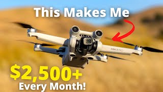
How My DJI Mini 3 Makes Me $2500+ A Month
zhlédnutí 896KPřed 10 měsíci
In this video, discover my simple method using the DJI Mini 3 and generating an extra $2500 monthly using free and affordable tools available on the market. I'll guide you step by step through the process of capturing data, cleaning it up, and making money with easy photos, videos, and NeRF technology. Thumbnail Photo Credits: ryanmense Drone Photogrammetry Course: www.pilotbyte....

Top 5 Ways To Make Money With Your Drone
zhlédnutí 52KPřed 10 měsíci
Breaking into the drone industry can be a daunting task. In this video, I will show you five different ways to start making money with your drone. The best part is that you don't need expert-level skills. These methods have been proven to help you get your foot in the industry, as they are the exact same methods I followed when I first started years ago. Since then, I have generated over $2 mil...

Is The DJI M350 Worth The Upgrade?
zhlédnutí 24KPřed 11 měsíci
In this video, we are going to take a look at the new DJI M350 drone that DJI recently released and see how it pairs up against the original M300 drone. We will look at the hardware and talk about the key differences between both platforms and the new things that come on the DJI M350 Learn more about Advexure: bit.ly/3NN46L8 Get the M350 HERE: bit.ly/3CVaZDD - ► Join us on Pilot Byte! Our platf...

Are Drone Pilots Becoming Irrelevant ?
zhlédnutí 14KPřed 11 měsíci
Are drone pilots facing obsolescence, or is their role simply evolving? Dive into this video as we explore the dynamic and rapidly shifting landscape of the drone industry. Packed with expert insights, we delve into the transformation of drone pilot roles, discussing the advent of automation, AI, and how these advancements are reshaping the job description of a drone pilot, making it an absolut...

The BEST Automated Drone Photogrammetry App! - UgCS
zhlédnutí 32KPřed rokem
In today's video, I'm diving deep into the world of drone flight planning using the remarkable mission planning software, UgCS. We'll take an in-depth look at how you can create an automated flight mission for your drone, execute a facade capture, and examine the generated data - all without the need for manual image capturing. Check out UgCS here: bit.ly/3BV9ftE Sample Data: Fry's Electronic S...
The DJI Mini 3 Just Got BETTER | DJI Mini 3 Photogrammetry
zhlédnutí 174KPřed rokem
The DJI Mini 3 Just Got BETTER | DJI Mini 3 Photogrammetry
A Beginners Guide To Drone Photogrammetry | DJI Air2s Giveaway!
zhlédnutí 22KPřed rokem
A Beginners Guide To Drone Photogrammetry | DJI Air2s Giveaway!
5 Drone Industries That Will EXPLODE In 2023!
zhlédnutí 154KPřed rokem
5 Drone Industries That Will EXPLODE In 2023!
How To Create Accurate Maps With GCP's - Drone Photography
zhlédnutí 37KPřed rokem
How To Create Accurate Maps With GCP's - Drone Photography
Drone Photogrammetry Mastery - Online Course
zhlédnutí 3,2KPřed rokem
Drone Photogrammetry Mastery - Online Course
DJI Mavic 3 Enterprise - The NEW King of Drone Photogrammetry
zhlédnutí 64KPřed rokem
DJI Mavic 3 Enterprise - The NEW King of Drone Photogrammetry
What Does A $350K LiDAR Project REALLY Look Like?
zhlédnutí 208KPřed rokem
What Does A $350K LiDAR Project REALLY Look Like?
DJI Air 2s = BEST BEGINNER Drone For Photogrammetry
zhlédnutí 30KPřed rokem
DJI Air 2s = BEST BEGINNER Drone For Photogrammetry
Top 5 Tips To Get PAYING Clients As A Commercial Drone Pilot!
zhlédnutí 34KPřed 2 lety
Top 5 Tips To Get PAYING Clients As A Commercial Drone Pilot!
The BIGGEST Problem With The DJI Mini 3...
zhlédnutí 32KPřed 2 lety
The BIGGEST Problem With The DJI Mini 3...
DJI Mini 2 Photogrammetry - The ULTIMATE Guide
zhlédnutí 85KPřed 2 lety
DJI Mini 2 Photogrammetry - The ULTIMATE Guide
5 AWESOME Ways To Make Money With Drone Photogrammetry
zhlédnutí 31KPřed 2 lety
5 AWESOME Ways To Make Money With Drone Photogrammetry
How To Charge For Drone Services - In 2023
zhlédnutí 222KPřed 2 lety
How To Charge For Drone Services - In 2023
Top 5 Mistakes To AVOID When Starting Your Drone Business
zhlédnutí 38KPřed 2 lety
Top 5 Mistakes To AVOID When Starting Your Drone Business
The Coasts of Puerto Rico in 4K | DJI Mavic Air 2s
zhlédnutí 2,3KPřed 2 lety
The Coasts of Puerto Rico in 4K | DJI Mavic Air 2s
Commercial Drone Pilot in Puerto Rico - Day In The Life (2022)
zhlédnutí 11KPřed 2 lety
Commercial Drone Pilot in Puerto Rico - Day In The Life (2022)
DJI's New BVLOS Drone? - Matrice 30 Series first impressions
zhlédnutí 4KPřed 2 lety
DJI's New BVLOS Drone? - Matrice 30 Series first impressions
How to build a SUCCESSFUL Drone Mapping business in 2023 - Drone Deploy
zhlédnutí 101KPřed 2 lety
How to build a SUCCESSFUL Drone Mapping business in 2023 - Drone Deploy
Did you use Classification? You skipped an important step from showing all the canopy to the beautiful contours in a click. How would someone create a bare earth surface return in Civil 3d without the classification of the points? How would someone create a surface including roads, etc. without providing 3d breaklines (tringular irrergular networks are created as surfaces in C3D - breaklines are required). I've used drone data for over a decade but the drone data is becoming to large with the new drones today. Surveyors are providing clients with unclassified Point Clouds without any 3d breaklines along the surface. Drones and lidar are very usefull tools but the files for some projects are to big and unmanagable and surfaces with Breaklines should be provided by the Surveyor to the client. It's probably our fault to some degree because we could require certain deliverables in the SOW.
Awesome video but I wouldn't really recommend any of this for amateurs, this is more aimed towards a bigger commercial scale for certified pilots with insurance. But you could probably do real estate photography pretty easily. But to add to this, joining one of your local drone clubs may give you additional benefits as they may have agreements with the FAA or CAA (if you're in the UK) like commercial insurance allowing you to earn money without any additional certification and may even include certification in the pricing too, so it's worth checking out.
I wish you would break down the various parts of your offer and how you charge for them.
Wouldn't drone pilots just use the ai tech making job easier
Sure you did buddy.
9:00 OSHA violation? I think the ladder needs to be tied off! 😂😂 Awesome video, super informative
Whoa that things a beast!
Would the DJI spark work for now until I get a new one? What do you like to use to send image files to clients ?
Do you technically need an android phone that has internet access? Or could I run an old android phone that I've had laying around that doesnt have data? Thanks for posting this video! I've been looking all over for just this kind of info!
When will this be available on the DJI app ❓ I have the mini 3
Great video man, I actually just picked up the Min pro 4 so I can try to start getting into this. Fingers crossed lol. How were you able to grow your client list, or even get started building a portfolio?
why would people developing / building a new property be living abroad? and how would you get in contact with such a person if you can even find a situation just like that? it doesnt make much sense from my persepective. im open to learning... can someone explain please.
would you like to review our drone?
Just getting into drones and I've gotta say, I think you just changed my life! Thank you so much. Subbed.
I just started doing this job, and I would like to know what you did to change the URL for your projects to make them accessible to clients? Does I need a plan, and if so, which one should I get?
great video Dylan! But I still can't use DD with my DJI air 2S... The flight "freezes" when the drone is at the right altitude and then nothing moves. Error somewhere, but where? I've reloaded the applications, but nothing changes. I can't figure it out. Do you have any idea what the problem is? jm
Thats actually really interesting
Very interesting - well explained !
so did u connect to that rtk network with this? or is it getting a tenth of a foot with just the RTK antenna alone?
I think the more important thing is how you find the clients because there’s plenty of courses on the technical knowledge on Udemy for like a tenner
So in my opinion the drone is one of many tools your using to make 2500 per month. The real money maker is your video editing software and knowledge there of.
Thanks for information
Thank You❤❤❤
What drone did you use for non rtk? Would a mini 3 Pro be good enough?
yeah ok it could work in the US but here in france that 2500€ would be around 1250€ after tax + nobody is going to pay for that kind of service cause you know... we pay too much taxes and can't afford it
It’s weird hearing drone pilots call themselves “commercial pilots.” Those are two very different things my friend.
I mean…. Legally they are considered pilots…. And they Work commercially……
$350k and used an AVIA. Talking about being a rip off. Same as DJI L series
Does this applicable for Air 3?
how do you advertise and get clients?
how exactly are you able to afford a 50 thousand dollar lidar and a 30,000 dollar drone..
Just stay out of national parks and you have my support.
Thanks for sharing your trait and the details, gives me and others new perspective of making money in new times
THIS IS SWEET! so what does your online course have that this video doesnt?
How do you get the customer?
Thanks am gonna check on that
in usa is easy to make 2500$ 😅.... but the idea is great world wide 😃
I'm new to all of this. But brother the best content and detail I have seen. Old School Marine looking to sharpen my pencil again and I just told my son that I have just went through a bit of college again in two videos. I've got it all in my head now. Because I logged it all in my daily book. haha. Man again, great content. Great detail. Great Job.
How many $ cost advanced photogrammetry with rtk, control points with accurate data?
where are you getting clients? They dont fall out of trees on to your lap.
Relationship building as anyone would do in any industry where you sell a service. Local developers, connecting with individuals on LinkedIn, reaching out to friends and family. Anything that will get you a lead is the best way to go about getting clients unless standing under a tree and waiting for a client to fall in your lap is what you do normally
Dylan, can't wait to check out this course. Loved your RTK course, a straight masterclass!
Wait it was 9 months ago and the project hasn’t been updated since? Did u get kicked off ?
No, I only showed you guys a few flights from this project as my client only gave me thumbs up on those few.
How is this for mapping? Using propeller AeroPoints and ppk
What about roll your own TPS; initially deploy several esp32's, programmed to act as fixed position transponders which communicate with your base station/drone.......in essence create your own terrestrial positioning system T.P.S on demand. Alternatively one could utilize and existing Meshtastic node network to calculate base station/drone position? Another good reason to participate in the opensource decentralized community based Meshtastic network.
Couldn't get past the loud crap music
Just keep in mind in most situations you can’t legally do this work unless you are a licensed Land Surveyor or working under one. At least in CA. Not positive about other states.
I do mention that within the course as it varies state to state. It’s more for understanding the basics on how they are created so that service providers know what to look and ask for on projects
Does that not entirely depend on what the map will be used for?
This video is available around the world.
is it better than phantom 4 pro which you can buy (used) for like 500$ now? It has mechanical shutter
Great video thanks! I got discouraged when the FCC started adding all the rules a few years ago and sold all my drones except DJI mini. My question is do you still have to get the 105 license to charge foe drone shots if the drone is under the 254 gram weight? Or can you use that drone and not have to get the FCC 105 pilots license? Thanks again you sparked my interest.. Ed Owen
What are your PC specs ??
Dylan this is so awesome I[m a VFX artist i[m very interested on photogrmetry, I have a question does UgCS compatible with DJI Air 3? _
I'm an old guy looking for a side hustle and happened upon your tutorials. Great work Dylan!