THE DEVIL'S PATH: The toughest and most dangerous hike in the East

Vložit
- čas přidán 25. 07. 2024
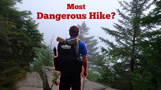
- The Devil's Path in the Catskills, NY is considered one of the toughest and most dangerous hikes in the East.
The Devil's path covers 24 miles and 8660 ft of elevation. The path summits 5 Catskill 35er mountains including Indian Head, Twin, Sugarloaf, Plateau and Westkill mountains.
2 of 8 NEU8 Completed.
Facebook: / outsidechronicles
Website: outsidechronicles.com


Awesome accomplishment! I gotta say, I've done this trail twice and when I saw you guys getting started at 7:00 I thought there was no way you were making it to the end. Definitely a very difficult hike - and it seems to get harder and harder as you go. One question - what kind of gps watch were you using to track your progress?
Thanks for watching the video and the subscription! I use a Suunto Ambit3 Peak for my GPS watch. My friend uses an older Garmin Forerunner. I love my Suunto, some of their new models are quite nice. I bought mine for the battery life and navigation features. Check out our latest Ultra hike in the Presidential Range.
Great Video, was googling Devils Path and I came across it. Thanks for sharing that with the world. Have been on many short day hikes but never considered myself a hiker. After watching that video and reading some comments I have to say I feel very inspired. Been driving through a lot of great spots for years on my way to Hunter and Windham but now hiking and all the great swimming spots are pinned for this summer. Gonna hit notch lake this weekend with the family.
Thanks for the comment. The Devils Path was a cool hike. The Catskills were beautiful, but I am partial to the Adirondacks. Both are 6 hours away for me.
The terrain looks so cool. I just saw where Notch lake is and see it's not far from Hunter. We hiked becker hollow in November and near the top the terrain looked similar to your hike. Loved how all the trees changed and moss all over. Would love to get to this trail in the spring or summer.
If you like the Catskills, you would love the Adirondacks. Many of the mountains are bald faces with exposed granite and 360 degree views. The terrain is similar to the Catskills with more rock scrambling. Thanks for watching. I have a bunch of ADK videos too.
That's a pretty aggressive trip, you guys blew rt through it, nice planning, great video
Cny Backpacker it was tough, we are shooting for the Northeast Ultra 8. We have 3 dine so far.
Awesome video!!. I just did this trail west to east!
Very cool! It was a fun adventure.
Loved the video. Plan on tackling the Devil's Path this year with a couple of buds though we plan on spending a night at Devil's Tombstone. Want to slow it down over two days and enjoy how blessed we are to live right between the Cats and 'Dacks. Any plans to hike the Letchworth loop or the NPT in the future?
Jeremy, thanks for the comment and kind words. You will love the Devil's Path. I would also recommend taking a look at the ADK Great Range Traverse. I plan to do the FLT through Letchworth this summer. There are a couple of lean-tos along the way. I think it is about 22 miles, will probably do it with my sons over a couple of days. NPT might be in the future, but for now me and my friend are working on the NEU8. Our next big hike is the Presidential Range. But am looking forward to an ADK High Peaks hike in a couple of weeks. Been chipping away at the 46er. ADK, Catskills, ASP and LSP are great reasons to live in NYS.
Well done.
Great channel...I live virtually in the shadow of the Devil’s Path, and I’m wondering why it’s considered so dangerous...I’ve hiked scrambles in the Adirondacks and in NH that we’re much scarier.
Agreed, I have been in sketchier areas in the Adirondacks and Whites. I think it has a high danger rating because of the high ratio of inexperienced hikers. DP was cool, but I’ll stick with the High Peaks.
I did that hike in winter. Hell of a time.
Great job
I have not done any winter hiking in the Catskills. I am one 46er away from my winter 46er. Did you do the whole DP in winter? A single day or overnight?
@@OutsideChronicles overnight.
I just did my first 2 ADK high peaks! Started w cascade and Porter. Next winter I plan on 10. I'm getting married in July and just got a new puppy so no trips for me anytime soon lol.
Wow great video this looks like a hell of a hike I just did panther mountain 2 days ago was great… one question I have a dog who hikes with me everywhere is devils path doable with a dog you think?
Thanks. As for your dog, there are a couple of sections where you may have to lift them up or lower them down depending on the direction. Personally, I would not take my dog.
Awesome.
Thanks and thanks for watching!
Awesome video!!! I have hiked a lot of high peaks in the adks but nothing in the catskills. Does this have a lot of smooth slab like the high peaks do? I really dislike the smooth slab the adks have.
No, smooth slab like ADK. There are rock scrambles, but no smooth exposed granite summits. Check out this video where we compare DP to the Great Range in ADK: czcams.com/video/-IwgGURYJkc/video.html Thanks for watching!
Hey, awesome video. Real quick, what did you guys use to store your food?
Donovan Kirrane do you mean where we stashed our bikes? We used our bear canisters. We camp in the Adirondacks High Peaks where they are required.
Slightly off topic question... what was the keto bar you were eating? Just getting back into hiking going to start backpacking this year and hope to loose weight and complete devils path. And long term goal is to become a 46er. Just learned about saddleback last night and a bit worried. Glad to hear your comparison of this trail to the great range. :-)
The backside of Saddleback is pretty awesome. It is steep. I did it as a Great Range hike, so we descended that steep part, which was a bit more challenging. You can do it. It always looks and sounds worse than it is. As for keto, it is called a keto brick. I did a quick review here: czcams.com/video/w4eXGU3iyJQ/video.html Also, I have a couple other keto videos on my page for backpacking. Good luck with your 46er, I got 4 more I hope to finish at the end of Feb.
How did you map out the trail in red on google earth and get that footage??
That is so awesome and I would love to show that for trails i have hiked.
It is kind of a process that I have actually updated. Now, I create animated maps with DaVinci Resolve, see czcams.com/video/LFgB4V6da7M/video.html and czcams.com/video/OdBqDpxwC8Q/video.html. To do it in Google Earth, you Open your GPX file for your route. I make mine with Caltopo. Then Play Tour (folder with arrow 3/4 down on left). Then you export as a movie. The flyover is cool with Google Earth, but takes a lot of tweaking to get right. The Davinci Resolve animations are much quicker to make. Check out Relive.cc. It does sweet flyovers of your GPX tracks.
Great video. Is there reflective markings to follow thr trail at night?
Yes, the NYSDEC discs mark the trail and are reflective which really helps at night with a headlamp.
Hey guys great video. I just subscribed. I'm just curious if you guys live in NY or where you're from. Also would you recommend doing devil's path solo? I'd like to do devil's path before the dead of summer. I usually just do solo hikes as I like to go at my own pace and sometimes that isn't other people's pace but it might be nice to have someone to enjoy the hike with and someone to kind of push me. Thanks again for the video.
I live in Western NY, Buffalo area. 24 miles is a long solo hike. I have done most of the Catskill3500 mountains solo, so with proper preparation and satellite messaging, if you can stand being in your head alone for that many miles, I do not have a reason to not recommend. Are you going to camp? Also, you will need a shuttle back since it is point to point. See you outside!
@@OutsideChronicles Hey thanks for the reply. I've always done things on my own mostly. I'm very comfortable being alone no matter how many hours or what I'm doing. Being alone for a 24 mile hike doesn't bother me or intimidate me. In fact I embrace being alone with no music or outside distractions nor conversations. It's just something I'm used to. The whole fact of hiking out in nature is to have that peacefulness and that calmness. That's very therapeutic and cathartic. I'm not saying I've never done any hikes that I've questioned doing it alone but I've gotten through them and it's made me that much stronger. I welcome the challenge physically as well as mentally. I don't plan on camping. I want to get to it and try to get it done within a decent time. I was going to do it this June but I've pushed it back to September/October. I think I'd rather do it in the so-called cooler months rather than the dead of the heat even though that would be another great challenge. A couple questions for you. Are there anything that you brought along with you that you found out you didn't need or is there anything that you didn't bring with you that you wish you did have? Also do they have shuttles that go back to the beginning of the trail or do I have to arrange my own ride back to my vehicle. Or there is always the option of out and back 😁😉. Thanks again, Gary
@@garybesaw Are there anything that you brought along with you that you found out you didn't need or is there anything that you didn't bring with you that you wish you did have? 10 Essentials and proper food and water. I believe we refilled water at Devil's Tombstone or another stream on the trail. So take a water purification system.
Also do they have shuttles that go back to the beginning of the trail or do I have to arrange my own ride back to my vehicle. No shuttles, there might be an outfitter that does it, but we rode our bikes back to the car the next day after camping.
Or there is always the option of out and back. DP is a thru-hike, point-to-point unless you want to do double the miles.
I'm doing this hike in 3 days time and my biggest concern is making sure I stick to the path and don't accidentally veer off....I'm mostly paying attention to the name of all the mountains so I know what signs to look for a long the way....a little stressed about it...any advice?
Start early and keep a steady pace. The trail is well marked and well traveled. You got this! See you outside!
Nice hike , I know the feeling !!!! Try dragging a bear out out of those spots !!!! It sucks 🙃
Ha, I’m good just hiking it. Thanks for watching!
Awesome video! I was looking at a map of the Catskill 35ers and it looks like Southwest Hunter is along the way to West Kill. Is that not part of the Devil's Path?
The trail to Hunter is along the Devil’s Path, but is a spur trail, less than a mile one-way. caltopo.com/m/AJFT#
@@OutsideChronicles Ahh okay gotcha thank you so much! I think when I try the Devil's Path in the summer, I will incorporate Southwest Hunter into it
rgrex1 are you doing it as a day hike or overnight? Best of luck!
@@OutsideChronicles overnight for sure! I'll have to work my way up to your great level of endurance before I can do it all in one day
rgrex1 There are some nice spots to camp along the way. Love to hear how it goes!
Did you only snack on the Keto Bar for the day?
I live less than 2 hours from here, and am planning on doing it, most likely solo (I really only have one friend in the area whom I’d trust to be a strong enough hiker to invite) as soon as I get 2-3 days of consistently warmer, sunnier weather. My hope is to park at the end, and take a shuttle to the start. I know that you guys packed your bikes, but, offhand, do you know of any shuttle companies in the area?
I do not know of any shuttle companies. It is not as accessible as some of the places in the White Mountains which is why we decided to ride bikes back. They might exists, but I cannot provide assistance. As for the keto bar, I did have other snacks, nuts, noosh packets and bacon. I plan for about 150 calories per hour on the trail. Good luck, it is a cool hike!
I'm planing on set up a team together for middle of June..
@@FrenchyHelpinghands Awesome good luck! Let me know how you like it!
@@OutsideChronicles i'm completely new to this area , so thank you for the input ..about to park to the end get a ride or shuttle to the departure.
Outside Chronicles me and a friend hiked this last Wednesday! Absolutely brutal, but we loved it! We parked my friends car at the end, my car in the middle, and took a taxi to the beginning. From the trailhead, we hiked in 2 miles to the Devils Kitchen lean-to, where we camped out for the night. We started at 630am and finished sometime after 11pm!
May sound silly. Where did the bikes come from?
Jennifer Torres-Keough we dropped them off at the end of the trail with some other gear on a waterproof box. Then we rode the bikes back to our car. It saved driving two cars from Buffalo and made more of an adventure. Thanks for watching!
All the footage is on the GoPro8?
hello world no, it was shot on a GoPro 6. I hope to upgrade soon.
So where's the danger come in?
Honestly, it is no worse than some of the climbs in the Adirondacks. The danger is overrated. I think some of the danger is its remoteness and unprepared hikers. There was only one section there was a bit of a steep down climb at 4:48, but it was not bad at all. No Saddleback cliffs, no Knife's Edge.
I just did this Wednesday
Well I did Plateau mountain to sugar loaf mountain.
Cool! The Catskills are beautiful. I am still partial to the Adirondacks.