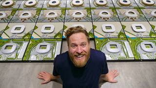
Printing Cities: Part One

Vložit
- čas přidán 3. 08. 2024
- In the first of a two-part series, I walk through the first steps of printing out a 3D map of San Francisco - sourcing LiDAR data, turning that data into a heightmap, and turning those heightmaps into 3D-printable models. (I offer some for sale these days at scaledindustries.com)
Part Two: • Printing Cities: Part Two - Věda a technologie


This turned out great! I know it's been about three years since you uploaded this, but is it possible for you to provide any further links/access to the resources you used to accomplish this project. Your video provides a great overview of how you tackled the problem, but it doesn't provide much detail for those of us that want to replicate your success.
This is awesome! I'm a remote sensing scientist and I really appreciate you explaining the basics of -DAR collection, as well as your use of Lastools, which I sometimes use in my research. I'm definitely going use your python script for filling in the base of my model. This is awesome! Thanks again!
Hello. Could you help me? How do I use the python script to fill in the base of the model, I don't quite understand how to do this part.
Finaly i find good man who tell how it possible to print. i try maybe 1 month to ffind a way. Big thanks!
Hi could you put links to the software please
Bravo, very good...thank you for sharing!
Oh man! Did you ever lose me with this!
Wow that's a huge amount of work! For a first project I think I'll simply go with terrain to Stl that's not very elegant but I think that would do the job for my 20*20cm tiles of tha Alpes at 1:300000 horizontal scale and 1:75000 vertical scale
Hey! Just wanted to say thank you for all of the information in this video. I just wanted to know if you had any advice on making a slightly flatter city stand out more using lidartile.
God bless you kind sir
you dont explain step by step :/
we want more 😊😊
Printing 1x1km in 3-4 hours is not quicker than printing 2x2km in 5-12 hours, so even with the "extra hilly" parts of SF, you're still saving print time. And then you save more time on not having so many tiles to do post-work.
Hi Andrew I love this tutorial but the only thing i can not understand is how you went from the elevation map from the 3d printable file, I know that you used your own program however could you link me to a download to that program or could you direct me to a program that can do a similar thing
Thanks Massi
We want part two! Great work keep it up. Going to 3D the city “the Hague” in the Netherlands
I'm working on it - waiting on a new 3D printer right now to try and solve some straightness issues, but I might just do a part two covering some of what I've been up to.
hey buddy love love love the video :) is there anyway i could get the print files to print london as i would love to have my home town on my wall here in canada also if you want money for the files i would be more then happy to pay for them
am i missing something? no lidartile.cli in the github files as per your run example, i change the python -m lidartile.cli -d to python -m cli.py -d which kicks out other errors please advise, thank you for your time
Loved the video - We have been trying to do a print like that. Subbed. We are a 3D printing channel!
Hello Andrew. How do you go about getting data that was during the war. Im after a 3D printed part of a city that was being distroyed by aircraft. So i can put aircraft in flight over the city to give depth thanks
Hi Andrew. Loved the video. Was exactly what I was looking for. Can you just let me know one thing.
When I create the asc from las2dem with aims to move it on to move it through QGIS and then on to print, the buildings always have angled walls instead of going straight down. With my personal troubleshooting (hours and hours so far!), I either gather that this is due to the original image seeming pixelated at the resolution I am trying to work with (if you agree, am I missing a step to keep higher render quality or is this down to the original laz file and something I cant do anything about (working with the National LIDAR Programme Point Cloud 2018 Data)) or it could be some sort of setting I am missing to only raster the image top points and to leave all other points as either ground or roofline. (again, if it is this or something like this any help would be massively appreciated.)
I understand that you posted this video a long time ago but would love your insight if you do pick this comment up. Happy modelling!
Well, the walls are always going to be a bit angled because the data shows that - if it says point A is 1m high, and point B is one pixel over (say a metre over) and 10m high, then you get a slope out of that. It's just the way that this somewhat simplistic approach to modelling works.
You can reduce it with higher-resolution data, but also as long as the slope is steep enough it's really not noticeable in the final print most of the time.
Do you account for curvature of the earth?
I would like to print my city! Please is there an easy way?
is there an update to this process? here did you find the uk data? it's a cool project, i like you
This guy smart
Any information on where to find lidar data of Chile? Thanks!
Can you 3d print Texas World Speedway with the buildings and track? They have torn it down but I understand the model is still on the old version. How can I get a copy so I can 3d Print it.?
It looks like the lidar data is sort-of there (I checked on apps.nationalmap.gov/downloader/), but 3D printing it would be tough as a race track doesn't stand out that much compared to the surrounding terrain.
@@AndrewGodwin Thanks for the information I wanted to use a CNC printer to print Texas world speedway best I can on a 2‘ x 2‘ piece of oak you would be surprised how many people I know would want to buy that
do you sell the stl files?
I Need Tokyo, Never Seen it :(
I have trouble finding Laidar data on Denmark! can some one help me with that ?
download.kortforsyningen.dk/content/dhmpunktsky
Any advice for Havana Cuba maps for this project? I cant quite find one.
Unfortunately, finding clean data is a big part of what's difficult here. It's quite possible there just isn't any for Havana.
Hi, I am having a few issues that id love for someone to help me with. For some reason, I can only have the divisor (-d) set as 1 without an error. Also, the resultant stl file is very large (9GB). Is there a way I can reduce this? Because it is to large for me to open.
The divisor has to divide into the number of rows/columns of your initial file cleanly - so, if you had a 1000x1000 input, you can't divide by 3 (because that results in 333.3 - it's not an exact division) but you could divide by 2 or 4.
And dividing down is the best way to get the filesize down - it reduces detail, but also massively shrinks filesize.
@@AndrewGodwin Thank you that is very helpful, I do have one follow up question though. I am am not sure the best way to determine number of rows and files in my .asc file. What is the best way of doing this?
@@AndrewGodwin It looks like I have 10,000x10,000 but I have tried a divisor of 2, 5, 10, 100 and others with no luck. Not sure what I’m doing wrong here unfortunately.
@@darksmash333 Afraid I don't really know what to do then, sorry.
So the creators of LASTools put a black diagonal in the output file generated by the unlicensed version now? That sucks
It's been like that for years - I don't really begrudge them, since I'm sure there's a lot of people who can pay but wouldn't if they could get away with it, but it's sad that it limits what can be done as a hobby.
Hello there.
Nice work you’ve done here.
Is there any change we can collaborate on a project like this ?
How do I get in touch woth you ?
Hi,
I keep getting this error when passing in my .asc file:
ValueError: Non-exact divisor!
What can I do to prevent this?
That means the file you passed can't be divided exactly by the divisor you passed - e.g. 2048 with a divisor of 4 is OK, but 1001 with a divisor of 4 is not! Try changing the .asc file to be a power of 2 in both dimensions.
@@AndrewGodwin First off, thank you for this awesome series! This inspired me to get a 3D printer. However, I would love some additional information to resolve this. What settings do I need to change in Las2dem to resolve this issue in the asc file?
Can I sell this for like $10?
I just sent you an email, please respond to it when you get the chance!
Print eilat
Boring
i keep getting this error
File "C:\Python27\lib
unpy.py", line 174, in _run_module_as_main
"__main__", fname, loader, pkg_name)
File "C:\Python27\lib
unpy.py", line 72, in _run_code
exec code in run_globals
File "c:\Users\dcast\Desktop\lidartile-master\lidartile\cli.py", line 57, in
main()
File "c:\Users\dcast\Desktop\lidartile-master\lidartile\cli.py", line 29, in main
ingestor.load()
File "lidartile\ingestor.py", line 40, in load
raise ValueError("Non-exact divisor!")
ValueError: Non-exact divisor!
any fix?
So my work place has asked me make a 3D printed map of Crawley (UK) how do u find the data on the enironment.data.gov.uk?
how to get rit of the black stripes?