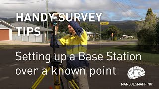
3 Tips while Using the DJI D-RTK 2 Base Station

Vložit
- čas přidán 2. 06. 2024
- The D-RTK 2
A comprehensive solution for data collection.
The D-RTK 2 GNSS Mobile station is not only a survey & mapping tool that brings survey grade accuracy for a range of DJI enterprise drone products but is also the go-to precision positioning piece of equipment for the range of DJI AGRAS agriculture sprayer drones.
Thank You for joining us in this video. We hope you like what was shared and we look forward to bringing you more in-depth videos on this and other similar products very soon.
Email : prodronesasia@gmail.com
Facebook : / prodronesasia
Timecode
0:00-Intro
0:05-Tip 1
0:10-Using D-RTK 2 as a static recorder set up
2:40-Post process (PPK) recorded data and looked at it
10:05-Tip 2
11:30-Tip 3 Using the D-RTK as a GNSS RTK rover for correction - Věda a technologie


This is great info! Thanks mate
Hope it helps. Cheers !!!
This is really informative. I must say thank you, it really helps.
Welcome !
Thank you for the info, it helped a lot!
Glad it helped!
Muchisimas gracias.
Bienvenido!
Great video, thanks for the info. A couple of questions:
I've read in some forums that the accuracy of the handheld mode (3) is not really good. Have you had any problems?
Is the D-RTK 2 able to communicate with other GNSS? such as Emlid RS2?
Do you know if it's possible to use it as a rover (handheld) while receiving corrections from an RS2 base or vice-versa? (use D-RTK 2 as base to send corrections to RS2).
We haven't had accuracy issues per se but the usual complain is slow to fix. The DRTK2 does not communicate directly with anything except the remote control. So as long as there is a way to connect the remote to another brand of stick (usually TCP) then it can be done. Cheers!
Fantastic content. Could you explain a little more about using the CORS Station data that you refer to? In my RTKpost app, the rover file window is just titled ‘Rinex OBS’ and the Base window is greyed out and unusable. When I put my converted .obs file in, along with the .nav file created from the RTKconvert that I got from the RTCM files, my error is very large and the points are scattered about.
For reference, I located a known point with a GPS receiver, set the D-RTK station on it, changed the base coordinates to the correct ones, and flew my mission. Do I need my local CORS base data that I used via network to locate the base point? Am I missing a step in the workflow?
A CORS station is a GNSS station that is Continuously Operating. It typically forms part of a service network of GNSS stations that you can connect to as a reference network in real-time or download RINEX data from for post processing.
For the issue with RTKpost, check the settings tab and set it to Kinematic. Then you should put your converted data into Rover and the data from reference to Base. Hope this help. Cheers!
Thanks a lot for explanation.
Wicht custom RTK Network you recommend?
It depends on what's available where you are using it. In Malaysia we have a national CORS network to subscribe and latch on to for correction data
Thank you. Your video helped me understand or D-RTK2. Please could you tell me the pinout of the connector of the external power cable. I bought a connector and I'm going to build the cable.
email me at wen@prodrones.asia and we go from there :)
Excellent video. Why when I connect the antenna to an ntrip service to take points on the ground, when downloading the points from the remote control and viewing them on Google maps they appear more than 1 meter from the actual position, some kind of coordinate conversion is necessary to view them on google maps?
We have seen this issue before. We suspect this is due to small offsets in the map services because when we place the points into the orthomap, they seem to align pretty well.
Can you use the data from Tip #3 method to get good measurements on that point, let sit for 15mins, then enter those values into the base station and connect base station to aircraft for RTK flight? Or just mark GCP's with that mode 3, then switch back to mode q for the flight?
That's typically what we recommend for a quick measurement of location. And since the pole height basically cancels itself out it makes thing easier to do. You just have to capture the value from the RTK settings menu by taking a snapshot with your phone. There is no automatic way to do this. Hope this helps !!! Cheers !
I've very new to this and trying to understand. If I want to use the Base station just to mark a know point, do I have to add the height of the antenna to the altitude reading? Or are the values displayed in the controller accurate as is.
Thanks
From testing, you have to subtract the pole height to get the position on the ground. Cheers!
Hola, alguien sabe como puedo unir o los :DAT datos origen del RTK-2 (lectura de 3 horas) o los archivos rinex convertidos?
Hello, when entering coordinates on the Mobile device, do you have to subtract the height of the instrument from the altitude?
Thanks in advance.
No you don't
About the Static Point Recorder...
If I want/need to record more than 1 hour of data, to be sure about a point near vegetation, I need to manually join the files data, or can I put in a mode that actually records more than 1 hour?
There is no setting to have the files merged. You will have to use some 3rd party tool for this. Hope this helps!
Hello, in static mode, is it possible if i use 2 drtk (in static mode), one as an anchor point with known coordinate and the other is observation point which will corrected with that anchor point? If possible, both of the drtk set with mode 5 correct?
Hi. If you have a P4RTK remote, you can use one as a base and one as a rover for real time measurements. If via PPK then 1 or 5 shouldn't matter for both. Hope this helps
Hi thanks for the valuable info, can this be achieve as a rover with a matrice 350rtk instead of a phantom?
Unfortunately DJI has not carried that function over to the newer platforms.
Is d-rtk2 on top of a known point? How did you input the known point coordinates onto drtk2?
So we can actually measure the DRTK2 position in 2 ways.
1) We use the measurement app in the P4RTK remote to measure vs a CORS network
2) We PPK the position of the DRTK2
Then we can switch mode and key in the coordinates. Cheers!
Hi, what rtk converter program are you using to extract the correction data from the d-rtk 2 ?
I am using RTKLib
Thank you, I will take a look.
I was reading on a DJI forum and they were saying to ADD antenna height to the Z value after it sits for 15 mins....then connect to rtk p4 drone and fly mission. But I've also seen where you Subtract the antenna height in the Z value to mark points for a GCP. I guess Im confused. If I use antenna only for corrections, let sit for 15, ADD to Z value and fly. IF just marking points for GCP, you minus the height? Any clarification would be helpful. Thanks.
So the concept is like this. You have an antenna mounted on a pole. And the reading you get is for where the antenna is.
So, when measuring the position of a GCP, what you really want is the position of the GCP on the ground not the antenna. So you subtract the pole height so that you virtually place the antenna on the ground to measure the GCP height.
The reverse is true when you want to set a reference point. You know where the point at the tip of the pole is but what you want is the position of the antenna. So you add the pole height from the GCP position to get the antenna height.
Hope this helps. Cheers :)
I have also read where if you are using the Drtk2 as a stand alone, no benchmark, no known point, just set up in an open field, and you let it sit for 15 mins and connect P4PRTK, you dont have to adjust anything in the Z value for antenna height and that the software accounts for that automatically so all you have to do is fly mission for accurate data. What are your thoughts on this? Thanks for replying to me. I'm grateful for your help in understanding this.
@@bnoll712 @prodronesasia5262 I'd like to understand that to, as I have also heard this.
fellow~pro deition-=))
Sorry, don't understand what deition means but thanks! :)
Also can we change name of D-RTK 2 when it appears on the Mavic 3E RC Pro? All D-RTK 2 showed name as "RTK"
Yes you can. Its in the advanced settings menu. Hope this helps
is it possible with DGI RTK2 as base or rover like gps geodetic in general?
The DRTK2 was built to work as a base but with the P4RTK remote, we can also use it as a rover. Since it also records the data it collects into internal memory, we can also use it as a PPK rover. Thanks!
@@prodronesasia5262 ok thx
I have to fly under a bridge. There, the GNSS antenna obviously does not record the position of the drone.
I have my D RTK 2 station in a near place where is very well connected and it is recording his correct position. It still communicate with my Matrice 300 and P1.
So my question is: Will my photos be recorded with the correct positions and so their geotag ?
Please someone answeeeer :)
Hi, first of all, without going too much into the details of how RTK works, the answer to your question would be maybe. Why? Because the job of the DRTK2 it to provide correction data for the RTK system in the drone to correct itself. So the RTK system of the drone still needs to receive GPS signals itself to be corrected. BUT, the system can work with partial shading and can hold some positioning accuracy with the internal guidance system. It will depend on ow wide the bridge is, how high it is, how close to deck you will be and how fast you plan to fly through the under side. Hope this helps.
DISCULPA LA CONSULTA DE SONDE OBTIENES EL ARCHIVO RNX MIN 3:47 TE AGRADECERIA LA RESPUESTA
How can I help?
Why is there a possibility to manually give the coordinates to the remote when using the base station? Is it necessary to do that and why woul you? wouldn't the base station know it's position?
A base station fundamentally only has the same accuracy as a standalone L1/L2/L5 GNSS rover. If we were to make it a base station, it would average a number of readings and use that as its current location. This means our centimeter precise drone location is only centimeter precise relative to the base but not in absolute terms like relative to a national datum. To do that, you would need a reference to accurately locate it (usually vs a CORS network or some existing network/database) and then key in the precise coordinates using the remote.
Cheers!
@@prodronesasia5262 Thank you for a good and clear answer! This was really helpful.
Where do you get the cable for the agras battery?
Hi, it used to come with the DRTK2 kit in the earlier batches. This cable I got from the early days of the P4RTK. They removed it some time after. If you want one send us an email and we can make a batch if there are enough requests. thanks
Can we use Rover mode with Mavic 3E RC Pro?
Sorry, the function is not available in the Pilot 2 app.
I can’t do tip 3 (rover) using mavic 3 enterprise, it’s possible?
Unfortunately that function is only available with the P4RTK
Can we collect points using DJI M300 rc or DJI RC plus controller
No. Sorry
HI, may I use this Station to set and record GCPoints?
Yes you can. There are 2 ways. If you have a P4RTK remote, you can record it using RTK. Otherwise, you just need to set it on the point, turn it on and wait for the middle LED to turn green. Give it 15-20 mins then turn it off. You can then extract the data and PPK the point.
@@prodronesasia5262 Does this work the same way with a Mavic 3 E RTK?
@@prodronesasia5262 so I have to link RTK 2 station to my ph4 remote controller and read coordinates on to the dji pilot app?
Great video, very interesting, but there is one small mistake in it, namely Emlid studio should be set to STATIC, not KINEMATIC!!!
Hi. Yes you are right if I were doing it to get a data point. I usually use kinematic to see how much the deviation data as we need it accurate and precise. So using kinematic, we can see the data spread to quickly see how good the quality of data is. Hope you get my point. Cheers!
Why you use mode 5 not mode 2 for base station? Thx
Mode 5 is the mode to use the base station to connect to the newer aircraft like the M300, M30, M3E and even the newer Agras models. There is no support for Mode 2 at the moment. Mode 4 is as a base for the M210 RTK V2. Hope this helps. Cheers :)
What software can I download to convert the .DAT file to Rinex???
You can use RTKLIB. One of the tools in it is RTKConv. I am using that in the video
EN QUE IDIOMA HABLA EL AMIGO????
Inglés mi amigo
Get a mic and take off that mask so we can hear
Masking was mandatory at the time in Malaysia but we are looking to gear up with a mic. Thanks for the feedback