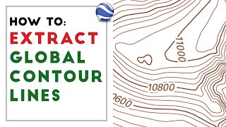
Generate and label Contours lines in ArcGIS

Vložit
- čas přidán 31. 07. 2021
- How to Generate Contours in ArcGIS for Desktop
This tutorial will show you how to generate contour lines from the LiDAR Image Services.
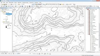
using ArcGIS for Desktop (requires Spatial Analyst extension). After the contour lines are generated, you will learn how to build an index and symbolize the lines appropriately. What are contour lines? Contour lines are vector features used to represent the landscape in a relatively familiar way. A contour is a line through all contiguous points of equal value. When are contour lines appropriate? Contour lines are used as a familiar media for representing the elevations of a land surface above sea level. These lines are typically used for basemaps and general topographic representation; contour lines do this appropriately. Contours should not, on the other hand, be used for analyzing the surface elevations above and beyond for aesthetic purposes.
In order to create smooth contour lines, we first need to smooth our DEM to ensure the vector output is data-driven. The most efficient way of doing this in ArcGIS is by using the Focal Statistics tool in the Spatial Analyst toolbox.
download free DEM 12 to 5 meters (world): • download DEM 12 to 5 m...
website: www.made4geek.com/


Super helpful tutorial, thanks!
Nice video
Thank you for sharing
Really helps me a lot
Cheers!
helpful
I can't seem to find the same options as you, when it comes to labeling contour lines.
Hi, great video. How do you export the contour lines and their labels to Google Earth?
Hi, what do you mean by ensuring that the vector output is data driven? I don't understand why you had to smooth out the DEM
i want to know what in units are the numbers labeled and how can i change it to meters
Applying Halo works if the background is of same colour. what to do if the background is in different colour?
Küçük ölçekli haritalarda uzaklaştıkça izohipslerin kaybolmasını istiyorum. Bir fikrin var mı ?
For some reason i cant add field in the table anybody knows how?
Mby it's dumb but tell me pls, what is number of contour and how do i get it?
Is there a video on how to even get to the first step in the video? lol, :') I'm new to the program and not sure how to even start
Edit: I figured out how to get the .tif file, but now I can't figure out how to find the toolsets. Mine is empty. I'm using ArcGIS Pro btw
Edit 2: nvm, i figured out that you need to use the search bar and it'll show up
I could not see the {contour}mod(25)