NISAR - Helping Farmers from Space

Vložit
- čas přidán 26. 08. 2021
- NISAR will provide maps of developing crop area on a global basis every two weeks. Observations will be uninterrupted by weather and provide up-to-date information on the large-scale trends that affect international food security.
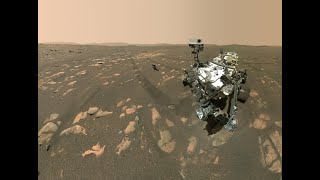
The NASA-ISRO Synthetic Aperture Radar (NISAR) mission, a collaboration between the National Aeronautics and Space Administration (NASA) and the Indian Space Research Organization (ISRO), will provide all-weather, day/night imaging of nearly the entire land and ice masses of the Earth repeated 4-6 times per month.
NISAR’s orbiting radars will image and track subtle movement of the Earth’s land and its sea ice, and even provide information about what is happening below the surface. NISAR will also provide information on crop area and forest biomass over time and with enough detail to reveal changes on field scales.
Credit: NASA/JPL-Caltech - Věda a technologie


Congratulations both the organizations (NASA+JPL & ISRO). Keep up the good work. 🎉
This is what the world actually needs. The world is a better place because of all the scientists working hard for a better future for humanity.
You guys are awesome! The future in the making!
NASA AND ISRO together will shake the dynamics of space exploration 💪🏻
Why I feel it's going to fail?
Amazing work everyone. I'm from Goolwa in Sth Australia next to the River Murray ocean delta. Certainly looking forward to what your maps will show. Congratulations to all!
That sounds cool!
That's so awesome!
Awesome👍👍👍
Amazing
Important video for Agriculture
Syracuse and UMass proud!!!
Food will be demand in upcoming decade however NASA take this seriously nice to see 😃
Really awesome
ಸೂಪರ್..... 👍👍👍
My dream was to work in NASA's JPL 🥺💔😇
Im almost qualified for application!
Interesting, thanks. Will the information be available worldwide? With droughts regularly happening, can the system be used to determine the amount of moisture in forests and other areas and determine their susceptibility to wildfires?
NASA made data from SMAP freely available for the world, which is a very similar mission.
@@andy4an SMAP and SMOS are course measurements. NISAR claims to deliver 60m data
It is incredible but maybe not that much practical for crop fields since it observes every 6/12 days. If accurate enough, they need to launch more of this type to enhance the temporal resolution.
Why would you need to (apparently) install those reflectors so precisely aligned?
Corner reflectors are designed to send the radar signals directly back in the direction they came no matter what the incident angle, but they can only do that if the three sides are at 90 degrees to each other. Misalignment means they would only work for some incident angles, and they wouldn't serve as a very good reference.
@@chaz720 yes, that I know.
@@johankotze42 One other thing they might be doing, this is a guess, is aligning the reflectors so they present their largest radar cross section perpendicular to the repeating ground track of the space vehicle. SAR images are always taken in the cross-track direction, so this would help them get a better known return.
@@chaz720 That makes sense.
What are the differences between the SMAP and NISAR missions?
The NASA Soil-Moisture Active-Passive (SMAP) mission was designed primarily for measuring soil moisture with both an active radar and a passive radiometer. The SMAP mission estimates soil moisture at 3000 m (3 km) spatial resolution. The wide measurement swath of SMAP allows a measurement every 3 days.
The NISAR mission has a high-resolution synthetic aperture radar (SAR) that has many science applications from measuring ecosystems, to ice sheet motion, to ground deformation caused by earthquakes and landslides. NISAR data will also be used to estimate soil moisture at either 60 m or 200 m spatial resolution as explained in the video, but it will only make measurements every 6 days.
@@EricFielding great answer, thanks!
This all started with SMAP👍
Yeah and "food security" was supposed to be solved by SNAP. Everything the left touches it ruins.
@@TheRadioAteMyTV . . . and everything the *right* touches it kills. It's a win-win situation for all Americans! 😷
@@TheStockwell Not sure you can back that up, but it's very easy to list the ruination of what the left touches. Maybe you missed what happened at the Kahbul airport yesterday. Oh what a long list or destruction the left has (Oscars, Sports, Education, NASA, now JPL)
Is bill gate involved in this project??
nasa + isro
yoooooooo
Carl Sagan was professor here.
👍😻😻
26.08.2021
Shouldn't a farmer be able to tell if the field is wet or dry?
Yeah? But why not let the thing in the sky see for you?, you can get places without a car, but it's faster with one, also this will reduce water waste by allowing farmers to make better decisions
Controling food supply.
They are not controlling anything, this is a project to show if an certain area is wet or dry what the farmer does with that info is up to him, if it's too dry he might lose some crop, so he might as well just water it a bit. That's all this stuff is making.
First
🥇
🤝°
Sounds nice did u clarify which earth to spy on ?! And how does this system all work? Not that your created holographic copy of earth just collapses cos u copy pasted and stole stuff without consent ?
*_1_* Of the 7.9 billion people worldwide in 2021, three billion (38%) have no access to working toilets, 1.1 billion (14%) defecate in the open, 844 million (11%) have no safe water, and 811 million (10%) go to bed hungry daily.
*_2_* There are now about 2043 billionaires and 14.6 million millionaires worldwide. What are they doing to stop those problems above?
💕 ☮ 🌎 🌌
This is useful to everyone and your point is whataboutery and not even within the scope of this project.
Have you seen the video? This stuff is to save water and produce food in a better way, it's a win win man.
they are space organization, not social organization. you're out of the topic
Nisar is Muslim name lol
This is not name this is Acronym
Nisar-Nasa Isro Synthetic Aperture Radar
Dear nasa please launch nisar abroad falcon 9 or hire a slot in Ariane 5 ,don't let isro launch much needed nisar abroad gslv rockets ,Our lazy scientists from isro just blown up a rocket and don't forget isro also failed millions of dollars worth chandrshan 2
And good luck with nisar
Really, "Food Security"? What's next, "Addressing pronouns from Space"? Please JPL, Get back in the game and get out of the wacky world of leftist terminology.
How is food security a left wing issue? Pretty sure MAGA country is going to be happy about this.
@@user-rl8kq9ig8j If you have to ask how food "security" is a left wing issue then you are swimming too deep. Look, people are either fed or they are not, "food security" is a first world problem invented by people who want more funding so they remain a top of the food chain (and boy is it working for them too!). Other than that I can't teach a fish that it's wet. It either knows it or it doesn't. That you don't know left wing from right wing terms yeah, how's the water? Is it wet?
Food security as in:we have enough land to make food for every one. Not literally secure food
@@kendarr That is NOT how the term is used in the media. The media (liberal media) uses the term to mean people aren't getting enough welfare to buy more food, when Americans already throw away up to 40 percent of their food and ALL of CA students (as of this year) get free meals at school.Food security is used by the same people who say "micro" aggression - as in so small one can't see it - never to be confused with Afghans who see their aggression and feel it in their bruises and wounds. Your definition may exist but it is not the one used on any network I have ever seen or heard.