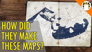
USGS Historical Topo Maps: Who Made Them

Vložit
- čas přidán 11. 07. 2024
- Doing a little research into the names listed on this old 1895 topographic map.
I see the same names on the San Jose map from the same year. Some names are different on the San Mateo and San Francisco maps from 1892 and 1899.
Avenza Maps:
www.avenzamaps.com/
You can have up to 3 user installed maps activated for off-line use in the free version if you want to try out a historic topo map.
TopoView web site to view/download maps:
ngmdb.usgs.gov/topoview/
USGS personnel:
Henry Gannett
www.thefamouspeople.com/profi...
Topographic Methods, 1906 publication:
pubs.usgs.gov/bul/0307/report...
Richard U. Goode:
prabook.com/web/richard_urquh...
Robert B. Marshall
www.watereducation.org/aquape...
pubs.usgs.gov/bul/0646/report...
pubs.usgs.gov/bul/0673/report...
oac.cdlib.org/findaid/ark:/13...
More to come...
Subscribe for more content like this
Comment, rate, share & click the bell icon
And as always, thanks for watching - Věda a technologie


Absolutely incredible. I was Turkey hunting in the PA big woods this past spring and sat on a ridge watching the sunrise, thinking to myself that somebody walked this entire landscape and marked the topography by hand.
Prior to that, the thought had never crossed my mind. Hard to imagine the amount of work that went into mapping the land in this era. Thank you for this video, incredibly insightful!
Yes, quite amazing work those guys did. I remember when I first loaded the 1895 map on my mobile device, I noticed there were some offsets between the map and terrain features I was at.
Initially, I was thinking those guys messed up, they should have calibrated the map with GPS or aerial photography, then recalled the creation date of the map. There were no satellites or airplanes or even cars/trucks back then. This was all done on foot or horseback and with simple manual surveying tools. And no uploading the day's data to the "cloud" either, it's all pencil and paper.
It's then that you realize the effort that went into making that one quadrangle and all the other quads than cover the entire country.
The other mind blowing thing is having that 125 year old map with live GPS location data and being able to navigate around like it was the 1890s and trying to imagine what it was like back then.
Seriously amazing stuff, can't believe what they did to originally map this stuff. Very cool how you tested it out with modern tech and real life placement!
Yes, it really is incredible. To think that all those old maps were done totally by hand. Survey data taken and recorded by hand, that data compiled and put down on paper, all by hand. I toured a USGS mapping office 30+ years ago and it was mostly computerized. They worked mostly with aerial photos and most of the time was spent stitching those together.
The first time I got it working out in the back country was a real eye opening experience. It was like I had gone back in time 125 years with the map, complete with my location displayed in real time.
Nice job! I'm studying quad maps used by Ohio EPA to mark river miles with pen. The maps are dated 1959 photorevised in 1970.
They used blue, red, green and black pen ink to mark "blue line" streams and whiteout for corrections. Thanks for sharing!
I cant comprehend how they did this so well. I make these with modern tech, but those great men of yesteryear are on another level
Yes, it is truly amazing what they were able to accomplish back then. Then, when you load up one of those 120+ year old maps on a handheld device and go out and navigate to locations on those maps sends a chill down your spine.
👊💕🔥