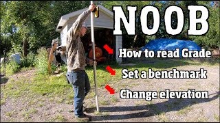
Key Tips for Site Grading (BEGINNER)

Vložit
- čas přidán 20. 10. 2023
- Are you an aspiring civil engineer looking to master the fundamentals of grading? Join me as we walk through a beginner-friendly grading exercise in a residential neighborhood. In this step-by-step tutorial, we'll cover the key elements every aspiring civil engineer should know when it comes to grading.
DISCLAIMER: THIS IS FOR BEGINNER-LEVEL CIVIL ENGINEERS.
What is grading?
"Grading" refers to the process of altering or shaping the surface of the land to achieve a desired slope or elevation. Grading is typically performed to prepare a site for construction, improve drainage, create roads, or make the land more suitable for its intended use. Here are some key aspects of grading:
Leveling and Shaping: Grading involves the removal or addition of soil and earth-moving activities to create a smooth and even surface. This can include cutting into existing terrain (excavation) or filling in low areas (filling) to achieve the desired topography.
Slope and Drainage Control: Grading is used to establish specific slopes and gradients on the land, which are important for controlling water runoff and preventing erosion. Proper grading ensures that water flows away from structures and roads to prevent flooding.
Site Preparation: Grading is a crucial step in preparing a site for construction. It creates a stable and level surface on which buildings, roads, or other infrastructure can be built.
Road and Infrastructure Development: Grading is essential for the construction of roads, highways, parking lots, and other transportation infrastructure. It ensures that these surfaces are safe, properly sloped, and capable of supporting heavy loads.
Landscaping and Aesthetics: Grading is also used in landscaping to shape the land for aesthetic purposes, such as creating terraces, slopes, or contours in gardens and parks.
Key Moments:
#1 Observe the world around you
#2 Understand the existing grade of the site (what are the elevations?)
#3 Understand the typical slopes you will use (minimums, maximums, typicals)
Subscribe to learn more about the field of land development! My channel will expose you to technical programs like AutoCAD/WaterCAD/ICPR, engineering tips and tricks, and professional development.
Also, I'm a self-published author. I wrote my first book to inspire a generation of students. Feel free to check it out below!
www.amazon.com/Boundless-Choo...


Would have been nice if I had a course in site grading in college as a civil engineering major. I had a hard time understanding it when learning from coworkers and supervisors early in my career. It’s more of an art form and using the min and max allowed slopes to drain water away from the building and towards drainage inlets. I understood doing spot elevations because that is just y=mx+b but I had a harder time drawing proposed contours knowing that it’s one elevation. Making sure you meet your min and max slopes in all directions based on surface type, parking lot, lawn, driveway, and knowing where to tie them into existing is the hardest part. To get the distance between 1 foot contours, take 1 foot and divide by the slope. 2% will have 1 foot contours 50 feet apart and 3 to 1 horizontal to vertical (33.3%) will be 3 feet apart. It’s important to be able to read a grading plan and being able to point out features like a swale, a berm, and a detention basin
Thank you Mr Land Developer PE. First time grading today and your video helped me 😊
awesome! glad I could help. thank you :)
This video is really helpful. It cleared some basic concepts. Thank you.
Thank you for watching!
Thank you
you're welcome! let me know if you have any additional questions
Great video sir! Getting back into land development after being out for a few years. A great refresher. Looking forward to the other videos.
Glad it could help! Engineer or designer?
@@griffinfurlong Engineer. Relocated to NC.
Great information, would like to see a video on how to grade (do contours manually ) for small sites like grading work around a upgraded culvert head structure.
Hand grade a site?
I'm just a drafter learning Civil 3d
Welcome to my channel! If there is anything you would like me to dive into let me know in the comments
Hi there, I hope you notice my message. Can you recommend a good book that have topics like drainage, grading, topography or Civil works in general? Thank you so much
I can try to find books but I’m more of a visual learner so CZcams has been my savior
@@griffinfurlong Thank you so much 🙂
To measure slopes with your phone, any specific apps to measure slope percentages?
You can use the iPhone measure tool and convert degrees to %
@@griffinfurlong Sweet, thanks!
immediate like....immediate like
Hope I was able to provide good insight! I don't want to make these too long and drawn out. In next videos we will dive deeper!
kinda thing you have to fake being intrested