Sentinel-1 displacements map in SNAP

Vložit
- čas přidán 12. 09. 2024
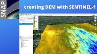
- This video shows workflow for obtaining a simple displacement map with ESA SNAP software and Copernicus Sentinel-1 SAR data.
Subscribe: czcams.com/users/c...
#SNAP #DinSAR #interferometry #tutorial #DYI #sentinel #displacementmap #DEM #DSM #elevationmodel


Can this be done for subsidence study? Loved your tutorial ❤️
Yes but you need a lot of more scenes at least 20. You can do it in StaMPS. Read about this and persistent scatterers.
@@MrGIS Do you need Matlab to use StaMPS or is their less expensive option?
Its nice class, but how to get polygons during subset that like AOI_WKT,i ts where i will be gets?
How can I produce the displacement values over time?
Its nice class, but how to get polygons during subset that like AOI_WKT,i ts where i will be gets?
And now I will be doing land subsidence, so how will get more videos' for that process, my teachers using SNAP software
Thank you very much for the video.
just a question is there a simple method to convert the displacement into a vertical one , or to 3D displacement?
Yes you can export displacements map as raster and visualize it in QGIS
Hi There, thanks a lot for your video, this is great, just a question, I see you are running the unwrapping under Windows, did you check this values?, I thought snaphu doesnt run properly over windows and you had to run it under Linux
Snaphu is available as plug-in in SNAP and works fine on Windows.
@@MrGIS thanks a lot for your answer :)
Thank you for the structured and very informative video! I started using SNAP recently and I notice that there's no option to do "Snaphu-unwrapping". Is that a Java class you added?
You need to install it as plug-in. From menu Tools--->plugins. Best regards.
@@MrGIS I have installed the Snaphu-unwrapping tool in the system and also as a plugin but I still can't build that step in the Graph Builder, Do you have an idea of what can be happening?
Thanks for this informative tutorial sir, is it possible to generate DEM contours with less than meter interval on Deformation area, I have to create elevation profile for small ponds in my study area.
Thanks.
Yes it's possible even up to millimeters but you need to use advanced InSAR methods and software like SarScape.
very informative!
can this procedure be applied to estimate glacier displacement as well?
I’d rather recommend PSI methods.
Excelent!!! what means the positive and negative sign?
Negative values mean subsidence, while positive values represent surface uplift.
Hello. Thank you very much for the class. I have a question, I'm generating an MDE but I'm not sure if I use IW1 or IW3. Some videos, the authors use IW1 and in others IW3, but do not explain the reason.
Thanks.
One SLC scene is made of 3 subswaths. If your area of interest is in one of them you have to choose correct subswath. Every subswath has a different area coverage.
greetings
MrGIS
i can not process my unwrapped file
please will process this?
Thank you very much for the video. I can't put the "snaphu-unwapping" button on the graf building, although I have installed the plugin. Tell me what to do?
And I have problem with Orbit Files.
How to calculate volume using displacement in SNAP software
Can displacement be mapped using InSAR in SNAP? Or SarScape is essential?
At this moment no. You need SarScape.
So this method we called Dinsar, right? Not Insar?
Yes
Si sir what an amazing job I wender if you can prove or find void with this technologie and what if I send you the location and you help me
How did you get the exact coordinates of the area you were analyzing (in the subset part)?
Yes that's right.
Dear sir, sorry, i mean, where did you get the exact coords? You were copying and pasting the boundaries of your area in the video. Where can I find that? My study area is in Naga, Cebu in Philippines.
I've made shapefile with my area of interest and then in QGIS made WKT (well know rext) from it. There is a plugin in QGIS.
Can we do this for multiple images.. ex- if w ehave to calculate subsidence for 5 years?
Actually no this method is only for 2 images. For calculating multiple images you need to use PSI methods. There is a plug-in for SNAP called STaMPS for this.
Is land displacement and land deformation is the same? And if so then can i use this method for land deformation study? Pls help
Can we use same process for land deformation?
@@shubhambhosale6028 yes land deformation and displacement are same.
@@vivekagarwal7134 thank you...
A useful and helpful video I subscribe to your channel. Can we use the same workflow when processing the CosmoSkymed dataset? I need your email please for further request. Thanks
Thanks. SNAP support CosmoSkymed but haven't processed any skymed data yet. I think workflow will be the same maybe different parameters needed. You have to test it by yourself. Best regards.
nice video. what the tite of the music backsound?
Actually I don’t remember 😀. Best regards.
It is possible if use 2 IW in S1- Tops corregistrstion, Like IW2 and IW3? And how to merge IW?
Yes. Look at my video for DEM creation czcams.com/video/7w_-deMSRTs/video.html
are you using pair scene?
Yes
@@MrGIS do you have tutorial on how to get the pair?
Check Alaska State Facility website there is a tool for best image pair selection.
@@MrGIS thanks
Thanks for the video
please can i get your email?