Real-time high-accuracy BIM data visualization for construction sites

Vložit
- čas přidán 28. 08. 2024
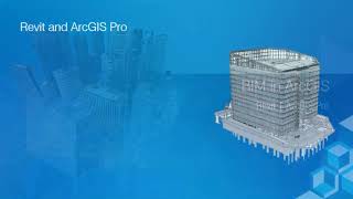
- vGIS Utilities (www.vgis.io) is a visualization system that brings your BIM data to your construction site.
Powerful integrations with Esri ArcGIS, Bentley iTwin and other sources enable fully automated model retrieval directly from your project repositories, which eliminates the manual effort required to convert BIM and GIS data into 3D objects. Location services display information relevant to each individual user directly on-site. High-accuracy (up to 1cm) fully-automated model placement ensures that BIM data is projected in mixed and augmented reality exactly where it should and without manual manipulations and QR codes.
vGIS Utilities is deployed broadly around the world to bring real-life benefits to its users.
Time stamps:
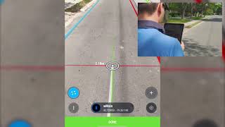
0:00 - 0:12 BIM with precise location
0:12 - 0:45 using Hololens 2, phones or tablets with vGIS AR
0:45 - 1:35 1 cm level accuracy with vGIS AR