Create Slope map from Digital Elevation Model in ArcGIS - ArcGIS for Beginners

Vložit
- čas přidán 5. 09. 2024
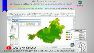
- Create a Slope Map from a Digital Elevation Model using ArcGIS. Open DEM and select the spatial analyst tool proceed to Surface and Select Slope tool. Create Slope Map, reclassify slope map.
Like to Support us, Join the Channel Membship:
/ @terraspatial
1. Open ArcMap -- Data DEM Data
2. Navigate TO -- Arc Toolbox Select -- Spatial Analyst Tool
3. Select Surface -- Slope Tool
4. Input Elevation or DEM data
4 a. Select the output file path and name
4 b. Select Z factor.


Have a lab exam in the morning so I'm watching it 🥺 and this is so easy 👍🥺
Thank you
Thank you for this video. It is very helpful. I appreciate you.
Hi Mr. Ajayi Oluwaseun, Thanks for your valuable comment and wonderful support.
Hello, I'm creating a map in a similar way- I made it display ranges of data as different colors and shades. So' let's say 25-29% coverage is green but 30-35% is more blue-ish while 50 is blue and it goes up to 90% and above which is red.
I have a few points added to this map and I need to write down the exact percentage, not just eyeball the colors.
How can I have ArcGis give me the value of the coverage in a specific point on the map?
Hi, you use identity tool to Find the value of particular point. Or you can create point shapefile and extract the values using the tool Extract Values to Points. Thank you
hi, im currently doing this on arcgis but the problem is only 2 classes only shows up (0-89%). any tips on how to fix it?
Hi, some times the tools gives error. Try not connect with internet. Please try onces
Great video! could you please tell how to download dem data from Bhuvan ??
Hi Mr.Haruhit Kunwar, In order to download DEM from Bhuvan please create a profile and in home website you can find Open Data Archive click it. Now select the satellite sensor list --> Cartosat -1. Finally select the needed tiles and download the data. Thanks for your valuable question.
@@TerraSpatial thank you so much🙏
nice
Hi Lalit bc, Thanks for your valuable feedback and support.
What are the criteria to give a z value!
Hi Moncyakkara, please refer this website www.esri.com/arcgis-blog/products/product/imagery/setting-the-z-factor-parameter-correctly/
Please can you help. My classification is coming in only 2 classes after performing slope. What can I do?
did you get solution for this problem?
i did it on aster dem it shows only one class ranging from 89.64 to 89.99
Hi, Mostly it is error only, but can you tell me you study location.
@TerraSpatial sir thank you for the reply yes sir it was a error..and I again run it on another computer it worked out correctly there
@@GeographyMadeEasy Great 👍