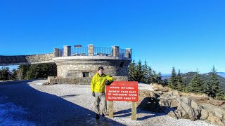
Cold Mountain - Shining Rock Wilderness, NC

Vložit
- čas přidán 8. 09. 2024
- This video shows the shortest trail access to Cold Mountain in the Shining Rock Wilderness Area of Pisgah National Forest, NC.
I started off Sunday with a flat tire, so my original plans had to be nixed. I needed a backup that wasn't a long hike, so I figured I would track the "quick" climb to Cold Mountain. It had been 5-6 years since my last visit, so it was about time for a revisit. Surprisingly the trail wasn't that crowded, I only encountered 5 distinct groups of hikers on the way up and down. The Art Loeb Trail was looking very pretty, especially at higher elevations below Deep Gap and the Cold Mountain Trail afterwards. I had the summit of Cold Mountain (6,030 ft) to myself while I ate a late afternoon lunch. The 180-degree views of the Great Balsam Mountains were great even though the visibility was a little hazy. I've hiked almost every peak you can see in my pictures, which is definitely satisfying. From the summit you can pick out almost every significant peak in the Shining Rock and Middle Prong Wilderness Areas, including Black Balsam Knob and Richland Balsam.
Hike was 10.4 miles with 3,435 feet elevation gain in 5 hours and 30 minutes.
Hike location
goo.gl/maps/tC...
Hike report
www.hikingupwa...


Thanks for the memories! One of my favorite Appalachian mountain hikes from my college days of over 50 years ago!
No problem, I bet it was lot more adventurous 50 years ago
I really appreciate your attention to the foliage and tree life at different elevations and locals. Also the information is plentiful on topography and terrain. Great video
Ha. I am fascinated with the variety of forests we have, but I can't name anything specific. I just point out hardwood, conifer, rhodos, etc...lol. I wish I was better.
I read alot about it. I like the geographic history of the Appalachians
From elevation you get a better vantage point. It's like a large topo map. Lol
I love the geographic history and sometimes the people's history of the area, that's why I buy so many hiking books.
Nice hike and very comprehensive narrative. Helps us folks that drive 8 to 12 hours to plan a hike.
Thanks, that's quite a driving commitment and I usually do 4 hours each way.
Zachary Robbins Headed up this weekend for a week!
In 2104 I hiked through Deep Gap and down the Art Loeb Trail, but it has been maybe 20 years since I've been to Cold Mountain. I need to get back to Cold Mountain, but the bear canister requirement in Shining Rock is somewhat of a deterrent for me. Depending on the weather forecast I may go backpacking in Middle Prong Wilderness this weekend. Thanks for uploading this video. Really enjoyed the views!
Cold Mountain is definitely worth the extra side trip, plus there are great campsites up top that I forgot about. It's also the only view from that angle you get in the wilderness encompassing all the other peaks.
I don't mind canisters, keeps everything organized and crush-free in the pack. There are too many people in Shining Rock who casually camp because of the Ivestor Gap Trail, and there's too much litter at every fire ring I come across. At some point I'm thinking they will require it for Middle Prong since it's easy to access from Sunburst, NC 215, and the BRP. They've already had temporary requirements for Linville Gorge and the Black Mountains in the past 2 years because of bad campers. My Middle Prong Wilderness video and the web post are some of my most visited, so I think it's becoming a more popular destination. I get a lot of emails about it compared to other hikes I've posted.
Zach always enjoy your videos. I live in bryson city. You really know the lay of the land.you know every peak and drainage. I use your videos for determining a hike. Thanks.
That's good to hear. I like compliments from mountain residents about my peak knowledge!
Stopped in the gap there for a rest and saw the Cold Mountain trail. We were going to the BRP and "noped" it. I'll go back again and do Cold Mountain another day.
Was that a one-day shuttle?
Really really enjoy your videos....love the areas you navigate...thanks for sharing...lots of great info and facts...
Thanks, appreciate it
Some of the best $800 views I’ve seen. Or however much it cost ya to replace those tires. Ha.
Pretty cool to view the ridge line and know you’ve hiked those peaks.
Less than that, but still expensive. Also had to replace my exhaust system 2 weeks ago because of rust. It's been an expensive month for my car. You haven't been to Cold Mountain?
Thanks for another fantastic video.....What portable GPS do you recommend ? Not really into buying updates for GPS and some seem overwhelming to operate. Looks like you have an entry level Garmin. Thank You !
Unless you're looking to track data for hikes, modify it, and post it on websites, I think your phone should be sufficient. The main benefit with a GPS unit is it has a slightly better signal and can easily be clipped outside your pack to receive that signal because of its design and these units are much more durable than phones. The handheld units are much better than phones for tracking full hikes, but for finding your location when you need to, they're not much different.
I have the Garmin eTrex 20. It's probably the best small GPS unit. There's really no reason to buy the eTrex 10 or eTrex 30. But it's personal preference. The larger units have gotten cheaper, but I don't need to upgrade. Honestly if you wanted a large GPS unit with many features, a satellite messenger would be better long-term.
www.outdoorgearlab.com/topics/camping-and-hiking/best-handheld-gps
www.outdoorgearlab.com/topics/camping-and-hiking/best-personal-locator-beacon
Any camping spots with water around Deep Gap?
Plenty of camping spots. There are small springs I think within third a mile below, but none around Deep Gap.
Hey so at these campsites is it legal to have a fire. I thought wilderness areas you couldn't have a fire at all?
It's illegal to have a fire in Shining Rock Wilderness, but that's not the rule for other NC wildernesses.
www.fs.usda.gov/recarea/nfsnc/recarea/?recid=48260
Whether it's in Pisgah or up in Shining Rock Wilderness, do you have a recommendation for a couple of newbies looking to hike for 2.5 days/2 nights? I have an 8 hr drive also and looking to come up that way 11/08-11/11.
More important than days, how many miles would you like to do each day? And what is your max tolerance for miles in a day?
@@bigzach322 We are newbs, so I would say 6-7 miles a day would be a good starting point for us.
@@disccop75 Do you have a bear canister?
@@bigzach322 yes
@@disccop75 Ok cool, the best hikes require a canister. Check out this loop and see if it seems too difficult or not. It is roughly 20 miles if you include Cold Mountain. It may also be easier doing this in reverse. Hike up Little East Fork Trail to Shining Rock Gap on Day 1, camp there. Roughly 7 miles. Shining Rock summit is just above the gap, fun place to explore. Next day hike the Art Loeb Trail north and camp on Cold Mountain. This is mostly level except a tough climb to the summit. Backtrack on Day 3 and hike the Art Loeb Trail to its terminus at the Little East Fork parking area. internetbrothers.org/2014/04/19/scout-camp-loop-on-art-loeb-trail-and-little-east-fork-trail-shining-rock-wilderness/