Calculate the volume of lake in ArcGis

Vložit
- čas přidán 5. 09. 2024
- To estimate the storage capacity of water bodies like lakes, ponds and reservoirs, can be performed through indirect methods, which calculate the volume of water retained through cartographic information, bathymetry and a digital elevation model are required for the calculation is performed with the tools of ArcGIS 3D Analyst extension.
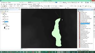
In this example, to determine the volume of water in a lake, open the contours of the study area (optional calculating the reservoir).
The volume represents the region between the surface and the space above or below the polygon features based on the selection made in the Reference Plane parameter:
Calculate above the plane-Volume is calculated between the plane and the underside of the surface.
Calculate below the plane-Volume is calculated between the plane and the topside of the surface. The surface area for the same portion of the surface is also calculated.
To see how to calculate the volume of mountain example of Mayon Volcano: • Arcgis calculate the v...
To see more videos visit website : monde-geospatia...


thank you very much brother god bless you
you saved my life fam
Thanks, a nice tutorial
Excelente!
Grt work brother!!! But how do u mark the points on the google earth i.e. above the plane & below the plane? please explain.
Is there any videos for calculating water spread area and area capacity curve using remote sensing datas
Just curious, why did you convert the TIN to raster? You could have performed the volume calculation on the TIN itself or you could have converted the points to raster directly.
Thank u so much
how you take water level as 1578m. Is there any easy method to take this depth.
If you have questions, welcome.
i'm questionas are you have sample data? sent email afit.gafar@gmail.com
Can you please send me the data
riasad23dec@gmail.com
thank you for this, but I need the sound
I did the same thing but I only get null values for the 3D surface and the volume :( can u help me please.
What units were you using to calculate the volume? Is the final output in liters or gallon?
Since input data is probably in standard SI units meters (m) -> output is in cubic meters (m³)
initially you added data how to get the data of a lake
oks tell it bro fastly ineed for my project
I dont know what value should I use as Plane Height, could you please help me?
Add your raster image in Google Earth, take the elevation from elevation profile, add that number as plane height.
4:04 I can not see the video because your advertising appears, thank you for removing it
Again no audio instruction.
How to get the stations shp, please....
Station shp: are data collected in-situ, corresponding to (x, y, z) for each station or point of measurement.
so, can I calculate just with DEM data?
You can't determine the depth of water from DEM, DEM is used to estimate the
capacity of a reservoir or watershed during dryness ..... y'll need
the depth of water.
what about the volume? must we do the ground checking to get Z value? because, I just have DEM, and don't have stations value, thanks