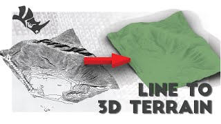
Rhino 6 3D: Turning 2D Topography into 3D Landscape

Vložit
- čas přidán 12. 09. 2024
- In this episode, we use an existing site plan to turn the 2D Contour lines into a 3D Topography
The main commands used were:
- Patch
- Lock
- Trim
- Boundingbox
- Editpton


a little trick i learned when raising contours to the right heigh in 3d is to select all of them and raise them by the max contour height, then deselect the top one and lower the all other contours by a contour height, repeat until they are all at the right height, this way you dont have to type a new number into the gumball everytime.
Great point! I do this sometimes as well
You can also raise the highest contour to its level. Then use the command distribute and select the z axis as the direction. Rhino will automatically move the intermediate contours.
try elevate curve command,, in Lands Design plugin
Outstanding video. It inspired me building a Grasshopper definition where the user can select the type of topological mesh for the contour given. I think this video is fundamental for developers, architect and students. It's very easy to follow and has so much potential for further development. I tried a Tatami Kairo, standard hexagons, standard rhombic shapes and few other mesh styles.
Basics always helps everybody get started with things that seems difficult. Thank you so much loading up this video here. Contour manipulation for terrain is always a tedious work that now seems even fun and trivial.
If you do develop a grasshopper script for this that would be amazing! Would definitely shout it out for ppl to see and use!
Hi, you can eleveate all curves with a single command in Lands Design: elevate curve command.
Great video! The channel is awesome, it’ll definitely grow with consistent uploads. Thanks for the help!
Thank you so so much!! You explained this very well, and legit saved me from this architecture assignment
That's the same method I use haha, Rhino is so sick for topographies!
Thanks man, that was very very helpful and was actually a very creative solution, simple solution for a complex problem
Glad you liked it!
Wow, this is so helpful! Amazing!
This was so helpful thank you !
thank you! super helpful
What made you think background noise is helpful in any way?
thanks it's been helpful :)
thank you it was very useful info, and love the calming music
Thanks! Glad you enjoyed it
Thanks a a lot bro , I was stuck
so informative bro .. pls upload more work...
Loving the background music! :)
What is it?
Sackville Gardens by All Night Sleeping Songs to Help You Relax, Sleeping Music & Asian Zen Spa Music Meditation
Thanks .. great work
really helped... thank u so much
Glad I can help!
if you are like me and already had contours, save yourself 9 minutes. Select all curves, type patch, done..
This didnt work for me…p
did you scale this? i'm having trouble learning how to scale the topography plan that i'm attempting to make into a 3d model on rhino6.
Nope, did not scale this. I was drawing 1:1
I think I’m going to use this command to make a realistic wooden beam
Sounds great! Would love to see it after you're done!
How do you add a road or a path on the generated topography........nice content btw
Try using the command Project if you have the roads in 2D
thank you!!!!!!!!!!!
How did you convert those lines from an image file in the first place?
It was a PDF file, rhino is able to read vector lines in PDFs just like how illustrator is able to!
soo good /..,man
How can I obtain a contour map for a specific site for rhino, like the one you start with at the beginning of the video?
If you're located in the USA, USGS is great: czcams.com/video/ovEO1zjSiVI/video.html
If in Canada: czcams.com/video/-JbuBAzQZXg/video.html
I'm not able to move the contours up and down?
Do you have a sample file i can download to follow the tutorial? thanks
We currently do not! Sorry :(
Wow who is this man?
Hi,
I use Rhino for architecture and often work with topographies. I start by building the existing condition from the survey drawing with a rhino surface and then invariably i will need to reshape the surface to accomodate the design. At the moment i laboriously fiddle with control points to try to manipulate it into the new shape I want. I also cut chunks out of it when i need to level it but its very awkward and clumsy and its really hard to get nice smooth transitions for embankments or road profiles.
Does anyone know different workflow that will allow me to sculpt a surface rather than cutting it and pushing around points? I am sure there is something that can achieve the results im looking for more elegantly.
Thanks for your feedback!
I feel you, I struggle with the same issues but have no solution for you. I think Revit is starting to get better at doing that and maybe our Civil Eng friends may also have a 3D solution. Keep me posted
@@lyh_studio I stumbled on a rhino command while ago that allows you to push and pull points with different degrees of pressure but I forgot its name and haven’t been able to find it since. Do you know that by any chance?
My current workflow means I have to constantly rebuild the surface with contours in order to get smooth transitions, so for the roads I will build a smooth profile with curves and then integrate them with the contours of the topography with the patch command. But every change I make I have to repeat the process it’s really laborious and inefficient.
Super good. Though I am having trouble moving my lines in a height witch is let´s say 0.5 or 3.5, all halfs it moves to the whole number either up or down. It´s driving me crazy. What to do here?
Hey! Sorry for the late reply but is your document set to snap to grid or anything else? That might be causing it.
Do you have any advice on how to get the contour lines for a specific site that I will be using for a project?
Sure thing! If you search up "extracting contour" on my channel, you should be able to find it :)
if the comand trim doesn't work?
Usually this is because whatever you're trimming doesn't intersect with the surface, or your surface is invalid. You can try to rebuild the surface or even extrude the curve that you're cutting with so that it cuts through the topography.
The problem here is that, realistic topographical geography IS NOT PETFECT😂. ESPECIALLY if you have alot of surface area or real estate. Chances are you're going to have to do the terrain in sections.
Totally agreed, these are good for base renderings - I actually have a more updated method to this that will give a way better surface. Check it out!
Hi, how do you group layers?
The way to do this in rhino is through "sublayers". Alternatively, you can group objects in the model instead.
ikd why but patch doesn't do anything with my curves
Are they in a very irregular shape with sharp corners? You can also check whether or not there are large gaps in your curves. Lmk how that works for you
Yes, I began by ensuring that each curve was one "single" crv. Additionally, I employed the 'simplify crv' command to simplify the curves. I also carefully examined for any irregularities or sharp corners, addressing those issues. Thanks for guiding me on what to look for in order to resolve the issue @@lyh_studio
where to find that file and how to import on rhino?
The file is not available to download but I suggest looking into PDF contours online and practicing with that. If you already have the linework in CAD or Ai, simply drag it in. Some vector PDFs work like that as well. Hope this helps!
@@lyh_studio Ok, I understood, thank you man
How can i get rid of the grid lines on the patch?
Rhino Options > View > Display Modes > Rendered and turn off isocurves under visibility
If I understood your question correctly
@@lyh_studio thanks for offering the help. There is what looks like grid lines on the topography, ig they are the surface u and v lines. How can I get rid of them so its all just a white/grey surface?
@@s.a.1083 Did the Method I outlined above not work?
@@lyh_studio No it didnt change anything
@@s.a.1083 Are you in shaded view? Ghosted view? That's weird, it should change the display
Use lands design for making contours in rhino it's too much easy
How?
would you mind explaining how this is done?
thank you!!!!!!!!!