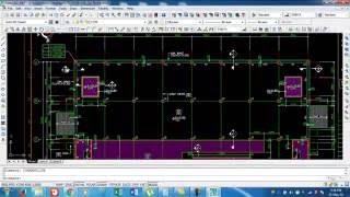
Convervet UTM Coordinates in Local Coordinates system & Use both in AutoCAD same drawing Urdu/Hindi

Vložit
- čas přidán 21. 05. 2019
- In this video, I try to explain how to convert UTM in Local
#Convert_UTM_to_Local #AdvanceAuotCAD #AutoCAD_for_LandSurveyor
~-~~-~~~-~~-~
Please watch: "Export layout points after design & apply Superelevation on Highway using Civil 3d in اردو & हिन्दी"
• Export layout points a...
~-~~-~~~-~~-~


Thanks Aamir bhai Allah pak ap ko khush rakhy
Ameen & thanks Wasim Mumtaz
Very very useful, thanks for sharing. Greetings from Colombia.
it's my pleasure
Thanks for the video. Really helpful.
You are welcome bro
❤
buhat khob sir well done job tnx
Thanks
Thanks for posting
Fantastic video mashall sir, Allah kare zoor-e-qalam aor ziyada
Ameen & Thanks Attaullah Khan
Ap kidir chala ga ho kafi time k bad ap na kuch comment kia ha ot group ma b shahid gahib he ha
@@aamir.shahzad sb men bemar ho gia hon thura diabetes (Shuugar) ka mareez ban gia hon jis ki waja se kafi tention rehti hy ziyda deer beth ny sakta dua ki appeal hy. thanks sir
Allaullaha Khan bahi
ALLAHA Pak ap sahat ata farmaha or humasha kush rakha Ameen
@@aamir.shahzad sb thanks and keep remember in your prayer
@@aamir.shahzad aamir sahib ja rahey baithey ho lahore ki gaadi mein aur ja rahey ho karachi video mein aik cheez ka samajh nahi hai keh aap boal kya rahey ho aur kar kya rahey ho
Eid mubarak sir
Ap co b Eid Mubarak
Niccc sir
asslamwalaikum bhai ramzan mubarak
W SALAM
Ap co b Ramadan Kareem
Thanks and your all video, useful for all surveyors, I have some doubts,
how to export topo survey data from excel to AutoCAD with distance per 5 m or 10 m each of every point plz I make sure that you will make a video for us and clear all doubts.
watch this video may it will help you if not then write again I will make new video as per your instructions
czcams.com/video/_ZVROCCUhoY/video.html
czcams.com/video/hpq8OOZeo18/video.html
Great
Thanks
A.A sir
sir ager client utm main drawing dy tu kya usi pr hi kaam kr skty hain mae jis pr kaam krny lga hn wahan coordinates utm main hain or northing easting negative main hai
example N -366.000
E -270.000
sir kya mae yehi coordinates total machine main dal kr resection kr skta hn ?
please sir reply me as soon possible
I shell be very thankful to you for this kindness
regards
irfan
g bilkul ap kam kar sakta ha
or negative value b ap use kar sakta ho
@@aamir.shahzad Thanks alot sir and Eid congratulations with lot of happiness
Nice Dear sir
thanks
Sir, can you please make a small video on Leica TS09 program :"Reference Plane"
plz help me in case survey data also rotet 180 digree how to rotet tru north with orginal cordinate in autocad or any more idea
Amir bahi Easting aur Northing main elhada elhada Scale factor add karan hy?
g nahi is k lia ap ya video dak la
czcams.com/video/cPjvLn5o4CQ/video.html
sir ap kuch aise link bhi shear kare jo gulf countries surveyour job de rahi ho cv kis trah bana hai kese un ko send krna hai awr top ke search engine page shear kare
Sir kal me ek naya site chalu karne valah he... Uame QATR qnd coordinates he... Dwg me diya he trunorth se plant north 27degree 57minut 12second gumaka reke he.. Isjo plant cordinates me. Kaise converte karega🙏...pls helpe🇶🇦
plz give me detail & solution for super elevation.
GPS garmin device ko system me connect karke survey drawing ko AutoCad me convert kese kare aur easting and northing point kese nikale. Ispe ek video banaye
GPS garmin Device whats that?
I need to export polygon extracted from autocad to Google earth at the same position I wanted. Plz help
Amir bahi likin Bench mark k coordinates ka kya ho ga kion woh tu UTM hoty hain .please wazahat ki jye gaa?
Dousri baat yeh hy k iss topic pr mazeed tashngi baqi hy.
Bench mark agar UTM ma ha to ap co sirf scale factor add karna ha
Amir bahi bench k Hawley sy wazahat darkar hy please?
Sir closed traverse kaise karegaa... Angle azimuth ke sath
Assalamu Alaikum brother
Wa alaquyam salam
Datum point ki tareef Bata den ?
dear sir Cordinates kitny types k hoty ha plz sb ka naam bta dy
Assalam walaikum sir,
This Tabrez khan
Mere pass ek drawing hai jisme written hai.
Plant co-ordinate system N:3000.00m
E:3000.00m Based on co-ordinate
N:3002864.508m E:321651.006 at moment.plant north rotated 48°36'49" East of true North.
Sir,
Can you explain me.
Dear Sir
how to convert UTM ABD 1970 DRAWING TO WGS84?
KINDLY ASSIT ME
drawing tu same jaga par ha already .....ap ne ucs rotate ker diya lekin drawing nhi.....its ok....lekin jab drawings ki initial coordinate ya reference coordinates malom na ho tu kaisay kamm kerna parayga
Kam karna k lia ap co kuch na kuch reference to drawing ma dia ho ga
What language is that ?
Gps cordinates ko Local cordinates kayse bnaye
Nice 👍
Thanks
bhai total station se hum ku kuch ki degree nikalna hai yaani hamare site per kuch colums inclined colums hai tu total station mein degree kaise check karenge bhai please isper ek video banaye bhai please
agar ap k pass kisi column ca ik point dia ga ha to ap co us point ca angle TS sa mil jaha ga or baki ap co pata ho ga k angle kitna ha woho ap + ya - kar sakta ha
Sir Talib Hussein sahib k plz link bata dye...
talib sb k video k nech comment kara woho ap co reply kar da ga
@@aamir.shahzad Sir un ki koiy b video ni mile rhi ...un k name search kya hai pr ni aa rha CZcams pr
These explanation does not match with the title. You are not converting UTM COORDINATE to local. What you did ia just explaining about orientation whether its true north or plant north but still all are plane coordinate. UNIVERSAL TRANSVERSE MERCATOR is out of context in this video. Just to avoid misleading..
Speaker buy kar len aik acha sa
Q bahi kha hova?
Sir gps ka base point world me kaha mana gaya hai.
ya ap google sa poch lo ya google map pa dak la baki her country ca apna hota ha
Main drawing sit karta hoon laken coordinate nahein nekal ty
Q? Ap lisp ca use kar raha ha?
How to convert longitude latitude in xy coodinate
Th bukhari
Survayior
Uae please Urdu language
Please Urdu language
Sir please mujy auto ka sitting batadoo
khon c setting?
@@aamir.shahzad sir coordinate sreen per show nai karta
hello sir ,
when i take a topography i have not real coordinates i decide two controle points velue ist point E=0.000, N=0.000, Z=100 and 2nd point measure distance velue . and after topograohy when recive real coardinates how to convert these local points in real points so that easting northing elevation and description convert in real points
Ask
Main Amir Bhai se ye jaana chahta hun ki TS se kisi masjid ki qibla rukh kaise set karenge. Pls guide me through any video
TS se kisi new masjid ki qibla rukh kaise niklen ge. Pls share video
is k lia ap co Qibla ca angle drawing ma dia hota ha or agar na dia ho to is kam k lia compas use hoti ha
Sir apaka wats ap number milega
Agar khoi question ha to ap lik da ma reply kar do ga
Use English please
Kuch samaj me nahi aaya