
- 148
- 1 118 644
MapTiler
Switzerland
Registrace 24. 07. 2013
Maps 🗺️ and software for building digital maps, which you can customize and integrate with websites and mobile apps. Join the revolution in web cartography!
MapTiler Server image mosaic
In this video, we will combine medium-resolution satellite images, high-resolution satellite images of the Zurich area, and a drone (UAV) image.
MapTiler Server now offers a virtual tileset - an easy way to blend global low-res datasets with local high-res datasets. Virtual tilesets can contain metadata. With that, it's possible to affect parameters such as attribution or title of the tileset.
MapTiler Server: maptiler.link/44S6KG5
Written how to: maptiler.link/3WQYvsa
How to install MapTiler Server on:
Linux: czcams.com/video/AzQBjhBstzQ/video.html
Windows: czcams.com/video/_PurCZiY9nM/video.html
Docker: documentation.maptiler.com/hc/en-us/articles/15942655931921-How-to-run-MapTiler-Server-using-Docker-Compose
MacOS: czcams.com/video/UE4VL-UxXXw/video.html
Open aerial map: map.openaerialmap.org/#/8.521255999803543,47.35156637750323,19/user/5ca54326e5635f000690af99/5ccb9c46a16d210005dad96f?_k=59dwhq
MapTiler Data dashboard: maptiler.link/4dLuG2b
MapTiler Engine: maptiler.link/3wICIYS
MapTiler Engine video series: czcams.com/play/PLGHe6Moaz52MKN2jkaNP2rOulAtAJI4z9.html
Chapters:
Intro
How to convert drone data to MBTiles
Download sample satellite imagery
Create virtual tileset
Color toning
Add drone imagery to the virtual tileset
Do you need the best maps for your web or mobile app?
Start with MapTiler at maptiler.com/cloud
Thank you for watching this video.
If you find this video helpful, don't forget to like it and subscribe to our channel for the latest videos: maptiler.link/YT_Subscribe
Follow us on
Twitter: MapTiler
Facebook: maptiler
LinkedIn: www.linkedin.com/company/maptiler/
zhlédnutí: 582
Video


How to create and use custom map style in MapTiler Server
zhlédnutí 803Před 3 měsíci
MapTiler Server: maptiler.link/49ONUAR MapTiler Cloud: maptiler.link/4d6Nzw2 How to install MapTiler Server and get the starting package Linux: czcams.com/video/AzQBjhBstzQ/video.html Windows: czcams.com/video/_PurCZiY9nM/video.html Mac: czcams.com/video/UE4VL-UxXXw/video.html How to download spatial data of specific regions: maptiler.link/49OqeMU This tutorial shows how to create a custom map ...

How to serve MapTiler Data from the MapTiler Server
zhlédnutí 450Před 4 měsíci
This tutorial shows how to download geospatial data from any part of the world and hosted securely from your own infrastructure. Download MapTiler Data and use them within MapTiler Server with ready-to-use map styles. MapTiler Server: maptiler.link/3PXgXed MapTiler Data: maptiler.link/4cRokxS How to install MapTiler Server and get the starting package Linux: czcams.com/video/AzQBjhBstzQ/video.h...

Learn how to make 5-minute map!
zhlédnutí 5KPřed 9 měsíci
This video shows how to make a map in 5 minutes. It works with polygon data that shows sea level rise in New York City. This quickmap was done with MapTiler Engine: maptiler.link/468syfP MapTiler Cloud customize tool: maptiler.link/45EaLxx In MapTiler Engine, large geojson is converted into tiles, and then those tiles are uploaded to MapTiler Cloud and added to the map. This custom map can be u...

Vector maps in Leaflet JS | Leaflet Tutorial 8 | 2023 tutorial step by step
zhlédnutí 3,7KPřed 10 měsíci
Step by step written guide: maptiler.link/3Q9xlrs Raster vs Vector: maptiler.link/3QdSwZz Mapping libraries with native support of vector tiles MapTIler SDK: maptiler.link/3FuSVl9 Maplibre JS: czcams.com/play/PLGHe6Moaz52My7w7pr3jpDL_2FqzljfWd.html This tutorial shows how to use vector tiles in leaflet js. The video shows how to add the plugin Basemap with vector tiles. Other videos in the seri...
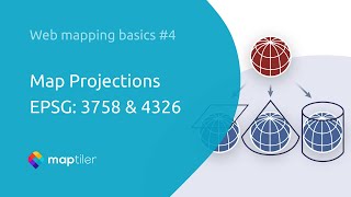
Map Projections EPSG: 3857 & 4326 | web mapping basics
zhlédnutí 4KPřed rokem
Do you want to know about map projection codes like EPSG:3857 and 4326? What is the difference between them? How do I convert between them? Search EPSG.io: Coordinate Systems Worldwide and learn: ► which reference systems are best for an area ► the code and attributes for each reference system ► conversions available to other reference systems Thank you for watching this video. Watch other epis...

Lat Long, meters, and pixels in web maps | web mapping basic 3
zhlédnutí 2,2KPřed rokem
Do you want to know how to convert between the different coordinate systems you need for web maps? Check out maptiler.link/tiles and learn: ► about latitude and longitude coordinates ► converting them to meters ► converting them to screen coordinates in pixels Thank you for watching this video. Watch other episodes in the series here: czcams.com/play/PLGHe6Moaz52MGhRHWZp_IhgeDO2u_WbRB.html Than...

MapTiler @SwissEconomicForum Award 2023 #SEF23 #SEF
zhlédnutí 227Před rokem
Watch our pitch @SwissEconomicForum Award 2023 as we showcase our cutting-edge geospatial solutions and highlight the transformative power of maps in today's digital world. Thank you for watching this video. If you enjoyed this video, don't forget to like it and subscribe to our channel for the latest videos: maptiler.link/YT_Subscribe Follow us on Twitter: MapTiler Facebook: faceb...

Google Maps API Alternative: MapTiler Cloud
zhlédnutí 10KPřed rokem
Switch from Google Maps Platform to MapTiler Cloud in 1 minute. Just copy&paste code from maptiler.link/3CiKw2C and add a marker maptiler.link/45SAinq Find an article on switching from Google Maps API to OpenStreetMap at maptiler.link/37yYRvV. Do you want to learn to create a map using the #Leaflet JS library? Check czcams.com/play/PLGHe6Moaz52PUNP4DtIshALDogSURIlYB.html Do you want to learn to...
Leaflet tutorial 7 add geocoding search | 2023 tutorial step by step
zhlédnutí 9KPřed rokem
Read more about MapTiler geocoding: maptiler.link/3S03uSG How to display a vector map with a leaflet: maptiler.link/3EaNoA9 Step-by-step written guide on how to add geocoding control: maptiler.link/3IpyTeh Download MapTiler geocoding control from npm: maptiler.link/3xlcUyO API reference for MapTiler Geocoding: maptiler.link/3K8O8cE This tutorial shows how to create a vector map with MapTiler ge...
Static Maps API | MapTiler Server
zhlédnutí 2KPřed rokem
webp format is coming soon! Follow us on social media to be the first to know. This tutorial shows how to use Static Maps API with MapTiler Server. After this tutorial, you can generate dynamic images with maps for your website or mobile application. Static maps are a great way how to use maps in previews, notifications, online receipts, fallbacks, and share maps on social media. Learn about Ma...
MapLibre | Switch between map styles #4
zhlédnutí 4,5KPřed rokem
MapLibre | Switch between map styles #4
Activate and deactivate licence | MapTiler Engine
zhlédnutí 317Před rokem
Activate and deactivate licence | MapTiler Engine
MapTiler feat. SotM 2022 | OSM Carto Style to vector tiles
zhlédnutí 543Před rokem
MapTiler feat. SotM 2022 | OSM Carto Style to vector tiles
OpenLayers Tutorial 3 | Map with polygon and popup from GeoJSON using JavaScript
zhlédnutí 13KPřed rokem
OpenLayers Tutorial 3 | Map with polygon and popup from GeoJSON using JavaScript
OpenLayers Tutorial 2 | Map with custom points from GeoJSON using JavaScript
zhlédnutí 7KPřed rokem
OpenLayers Tutorial 2 | Map with custom points from GeoJSON using JavaScript
OpenLayers Tutorial 1 | Map with a marker using JavaScript
zhlédnutí 17KPřed rokem
OpenLayers Tutorial 1 | Map with a marker using JavaScript
Svelte map with a marker maplibre gl js | 2022 tutorial step by step
zhlédnutí 3,2KPřed rokem
Svelte map with a marker maplibre gl js | 2022 tutorial step by step
Build a map in Vue.js in 5 minutes with MapLibre GL JS | 2022 tutorial step by step
zhlédnutí 9KPřed rokem
Build a map in Vue.js in 5 minutes with MapLibre GL JS | 2022 tutorial step by step
Learn in 5 min how to build a map in Angular | 2022 tutorial step by step
zhlédnutí 10KPřed rokem
Learn in 5 min how to build a map in Angular | 2022 tutorial step by step
React map with a marker maplibre gl js | 2023 tutorial step by step
zhlédnutí 10KPřed 2 lety
React map with a marker maplibre gl js | 2023 tutorial step by step
Zoom levels & map scale | Web Mapping Basic #2
zhlédnutí 5KPřed 2 lety
Zoom levels & map scale | Web Mapping Basic #2
MapTiler: self-hosting solution for your spatial data
zhlédnutí 1,6KPřed 2 lety
MapTiler: self-hosting solution for your spatial data
MapTiler Real-world maps for World Creator
zhlédnutí 9KPřed 2 lety
MapTiler Real-world maps for World Creator
Map tiles & pyramid: How web maps work | Web Mapping Basic #1
zhlédnutí 8KPřed 2 lety
Map tiles & pyramid: How web maps work | Web Mapping Basic #1
Satellite 2021: maps for apps and websites | MapTiler Data
zhlédnutí 818Před 2 lety
Satellite 2021: maps for apps and websites | MapTiler Data
Story of Copernicus Masters winning project MapTiler at ESA PhiWeek 2021
zhlédnutí 233Před 2 lety
Story of Copernicus Masters winning project MapTiler at ESA PhiWeek 2021
Hi, Can I customize 3d buildings or all any customer illustration to the map?
Hi @seans.111, I'm not entirely sure what you're trying to achieve. However, generally, yes, you can add 3D buildings, models, and custom illustrations to the map. Generally, it will be easier if you use a map library that works with vector tiles directly e.g. MapTiler SDK. Then you can add a 3D model: maptiler.link/3X2ej9S another option is to customize a map and add their custom illustrations maptiler.link/3XvsMNa or use map style, which includes 3d buildings like MapTiler Streets maptiler.link/3z00v7S If you have more questions, please get in touch with us: maptiler.link/43Ok1xn
Can i use it for Etap software?
@sidahmedbensaad1838 It depends on what exactly you need. It's possible to export diagrams from Etap to a format we can read with Engine, then it can be georeferenced and exported as a tileset that can be read by the Server. For more details, get in touch with us: maptiler.link/43Ok1xn
How to show direction between origin and destination
Could i use this on my chosen server? Not on your server. It's limited of MAU. If i use any other server, there is unlimited MAU for end-user
Hello @jenialherdianto292, MapTiler data can only be used with MapTiler Server for commercial use. If you contact our sales team at sales@maptiler.com and provide us with your specific use case, we can find the best solution for you, or you have an option for DIY with open source at openmaptiles.org/
I am SO confused now.
@GiantLeapLife, where did you get lost?
@@maptilerofficial In the console it just could not find the path. I have tried various variations like "cd./" "cd ./" or using no "cd", because I don't even know what it stands for...but chat gpt told me it is to search - for people like me it is ok to explain these things a tiny bit more in detail 😅. I would love to be able to use this programme, but I got a sense it might rather be suitable for programmers and developers, or at least people who know some of it at least. It would be nice to have a slow paced MapTiler tutorial for absolut Über-Beginners maybe....The programme and what it can do seems really really awesome. I am a bit gutted that I am not able to understand it properly (but that is because of me).
@@GiantLeapLife Thanks for the feedback I didn't realize that can be a challenge :) The folder from which I am running MapTiler Server in the video is called "server" and it is inside "Documents" folder. To get to that folder in the terminal, I use the command cd and specify the relative path to my "server" folder ./Documents/server, then I enter the file mailer-server with the command ./maptiler-server. If you have more questions, please contact our support team documentation.maptiler.com/hc/en-us/requests/new I don't know what your is use-case, but if you want to create a nice map for the web without programming, it might be easier for you to use customize tool from MapTiler Cloud: www.maptiler.com/cloud/customize/
Will your api work on java based geofencing mobile application?
You lost me at the black orange.. where did you find that thing..
Hi, I would like to create a location marker that animates when event listeners pick up on mouse overs and right clicks so the the marker animates with a mouse hover and a highlight when right clicked that you can also click and drag the marker to another location on the map. I understand you can achieve CSS animations with 'ol.Overlay' and drag and drop capability using 'ol.Feature' but I would like to use both together to get the desired effect. Can you or anyone possibly explain to me how this can be done?
Hi I'm trying to subscribe flex package but it's not accepting payment
Hi, @ibrahimgasser4515 contact please our support documentation.maptiler.com/hc/en-us/requests/new
These instructions are so vague. I loaded in the sample map data (maptiler-server-map-styles-3.14.1.zp) and half of the world is missing when I view the map. I loaded in the following: - /fonts - /maps - maptiler-outdoor.mbtiles - maptiler-satellite-mediumres-2021.mbtiles I also get a vague error for each of the maps: Not available source(s): 'maptiler-landcover'
I wish to remove the marker when I click anywhere on the map. What code do I need for that? I tried the code below but it does not work. Or can I use removeFeature() in some way? map.on('singleclick', function (evt) { map.removeLayer(marker); });
It's been a while, it looks, since you asked this but this might help if you still need to remove the marker by clicking anywhere on the map. 1. Initialize variables to track the selected marker: let selectedMarker = null; // Function to select a marker function selectMarker(marker) { selectedMarker = marker; } 2. Add a 'click' event listener to the map: map.on('click', function (evt) { const pixel = map.getEventPixel(evt.originalEvent); const features = map.getFeaturesAtPixel(pixel); // Check if a marker was clicked if (features.length === 0 || features[0].get('type') !== 'marker') { if (selectedMarker) { map.getSource().removeFeature(selectedMarker); selectedMarker = null; // Reset the selected marker } } else { selectMarker(features[0]); // Set the clicked marker as selected } }); 3. Ensure markers have the property 'type' set to 'marker': const marker = new Feature({ geometry: new Point([longitude, latitude]), type: 'marker' }); This setup should remove the selected marker when clicking anywhere on the map except on a marker itself. Hope this helps.
"BuT iTs SiX ePiSoDe"
I'm sorry guys to say that, but I think I gained 0 information from ur tutorial, plz improve and organiz it again
Would you like to get professional support? Check out MapTiler Server: maptiler.link/4buJUqC
Would you like to get professional support? Check out MapTiler Server: maptiler.link/4buJUqC
Would you like to use a graphical interface and get professional support? Check out MapTiler Server: maptiler.link/4buJUqC
Maptiler is expensive
New version: czcams.com/video/L3U-hJrg1Ek/video.html
Gracias por compartir
You are very good at explaining the matter + animations are great! Thank you very much!
Thank U So Much
Gracias por el gran tutorial
I want to upload a normal map without borders with good resolution as an image how is that possible please help me
Cần bản đồ Maptiler Mobile trên appstore 😢
@TheVietkhanh Keep watching our social media channels later this year, you never know! 😉
@@maptilerofficial vâng. Mình mong sẽ có trên appstore
kind of misleading. you say it is a tutorial for open layers, yet i have to integrate maptiler. this doesn't work. anything chrome could be blocking?
@DJ-pn9te Hi, sorry to hear that can you give me more details about what is not working?
is there anyway to render 3d satellite terrain map?
@yearsago20 yes, the easiest way is to follow this tutorial maptiler.link/3J8cBgF and just replace maptilersdk.MapStyle.OUTDOOR with MapStyle.SATELLITE
@@maptilerofficial thanks
These actions can reset the styles of other layers.
I agree with this, so is there any solution to prevent that?
1:33 update: Just drag and drop zipped map data directly to the MapTiler Server interface!
Does geocoding works for the android studio?
@dinesharts3377 Yes - sure it does. You just add into your application code the calls to our Geocoding API endpoints documented at docs.maptiler.com/cloud/api/geocoding/
Can i use it for android development in android studio using java
@dinesharts3377 Yes, you can use MapTiler Cloud free plan for testing purposes.
Any api key is free Which tell the user current location and show the shortest path from user to selected hospitals direction also show time and distance in node.js
Is it free or cost
@SuperHero-7 Both basic plan is free, and it's enough for testing purposes. See more at bit.ly/4cvH7yy
Any more videos for the series? Love for this to continue!
@beertocode Thank you, do you have some specific topic that you would like to see?
How to implement it for wordpress page?
Hi, you can use widget. Read more about it here:bit.ly/3OG8mMe
❤
what should i do if i need 2 types of icons?
Can i use it with ionic?
yes
@@maptilerofficial do I have to use an api?
@@alaindarcyarakaza7858 Yes, if you want to use maps from MapTiler Cloud, but if your use case requires a secure environment, you can host maps from MapTiler Server. Read more about MapTiler Server: bit.ly/3OGKesX
rip
you helped me a lot and i am very thankful love you keep up the good work; chlakha toum :)
Is this API free of Cost to use?
i try download map style, and try go to asia is blank. im stuck
Hi @TheRolldone to make it work, you always need to have data to which style will be applied. Do you have geodata of Asia in MapTiler Server? In case the issue persists, feel free to reach out to support@maptiler.com with a report generated according to bit.ly/3tJDRxO
Any chance you guys can work on a Flutter SDK so that customers don't have to create Android/iOS custom platform code?
Hi @aloh86, You can use our maps with flutter. Here is how: bit.ly/3RLZCFp
the real case is what if we have a lot of geojson? is it getting slow?
Yes, a lot of geojsons will be slow; in such cases, it is better to convert geojson to tiles. You can do so with MapTiler Engine: bit.ly/4aFBSvl Then, you can include those tiles in the map.
So, my question is how do I remove myGeoJSON? I want to be able to toggle it on and off with a button.
1:30 Hi, can I fill the polygon with a 'backgroundImage' or something like this here? thanks for the video.
Can I use it with react
@akashagrawal2432 of course. Here is how: czcams.com/video/ueaP7ShYE8I/video.html
thank you this really helped
I buy a flex plan. I need a map in jpg or png format to animate in AE. where can I find a tutorial? Not among a thousand extensions I don't understand how to do a simple operation like exporting an image.
Hi @postscriptum22 MapTiler Cloud currently does not offer the option to directly export your map into jpg/pn output. However, there is an easy solution for that. Just follow these two steps: 1. Share your MapTiler map in QGIS via WMTS: documentation.maptiler.com/hc/en-us/articles/360020803777-Open-maps-in-QGIS 2. Export your map as a jpg/png raster image: docs.qgis.org/3.28/en/docs/user_manual/print_composer/create_output.html#export-as-image In case we can assist you with any other case, please contact us at support@maptiler.com
Thank you. Can you make this tutorial with react js please? Many thanks.
@zerdadutubechannel6927 yes its in the plan :)
Looks very interesting. I'll have to play around with this since I cannot afford ArcGIS Server for a personal project! Thanks for making this free for non-commercial use.